Civil Engineering, Municipal Services Engineering, Water Resources Engineering
Municipal
Parks & Recreation, Water, Sewer & Storm Infrastructure
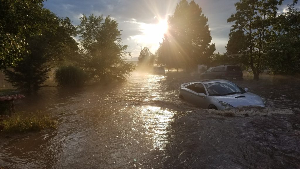
In July 2018, Englewood faced unprecedented 100-year flooding events that severely impacted three major basins,...
Municipal Services Engineering, Whitewater & Rivers Engineering
Master Planned Development, Parks & Recreation
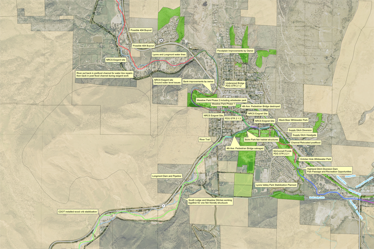
Calibre’s Whitewater Team played a pivotal role in the development of the South Saint Vrain...
Civil Engineering, Construction Phase Services Engineering
Private
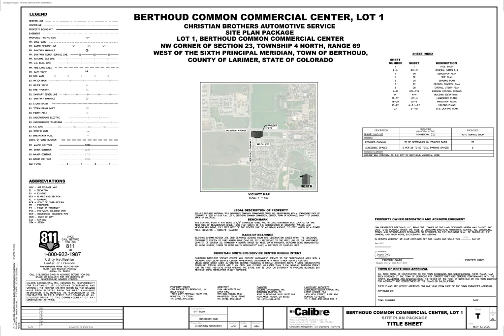
Auto & Maintenance
Located at the southeast corner of Mountain Avenue and Berthoud Parkway in Larimer County, Colorado,...
Parks & Recreation
Calibre’s Whitewater Team played a key role in the successful recovery project following the devastating...
Civil Engineering, Federal Services Engineering
Federal & Military
Cultural & Religious Facilities, Parks & Recreation, Residential, Water, Sewer & Storm Infrastructure
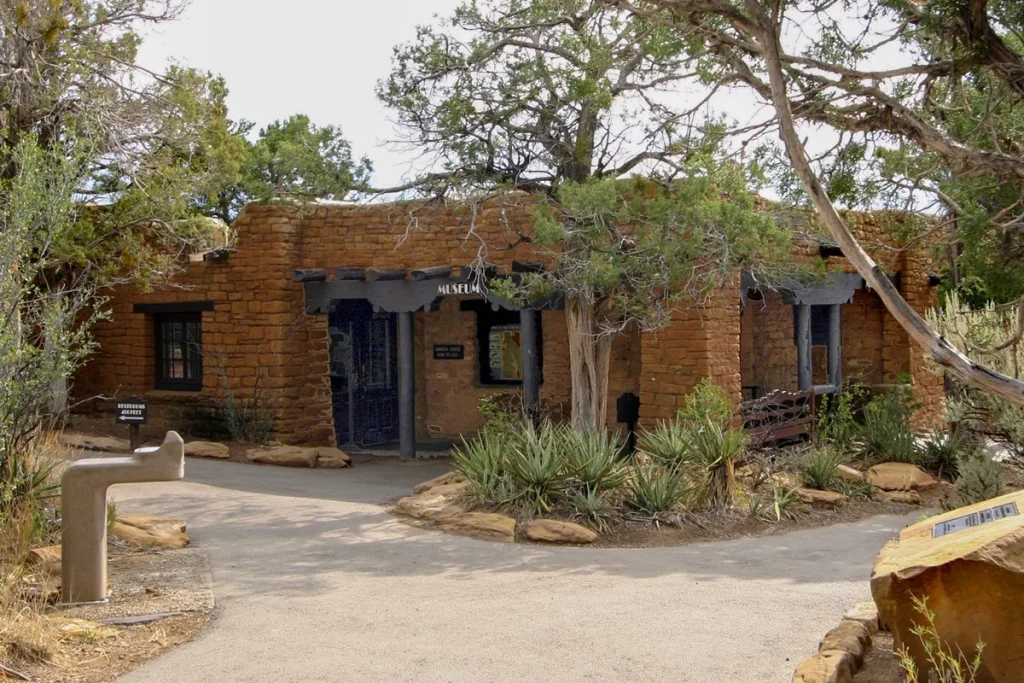
Located within the historic Chapin Mesa Historic Buildings and National Historic Landmark District, this significant...
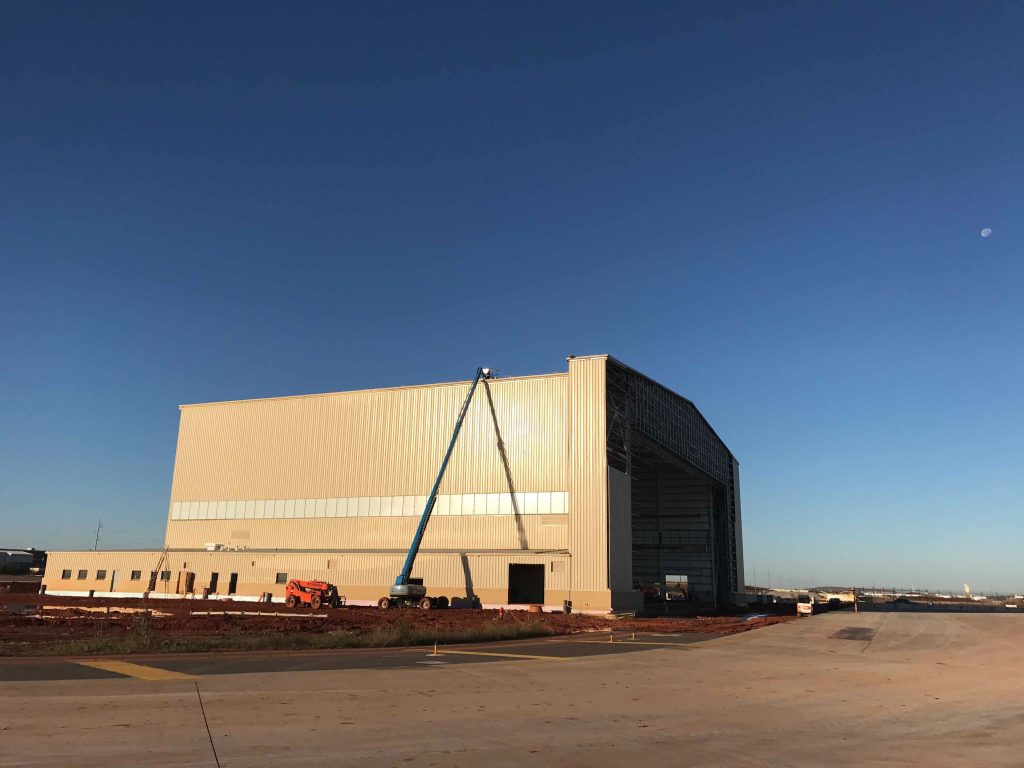
Aviation, Design Build
Calibre provided civil engineering services for the aircraft hangar at Tinker Air Force Base, Oklahoma,...
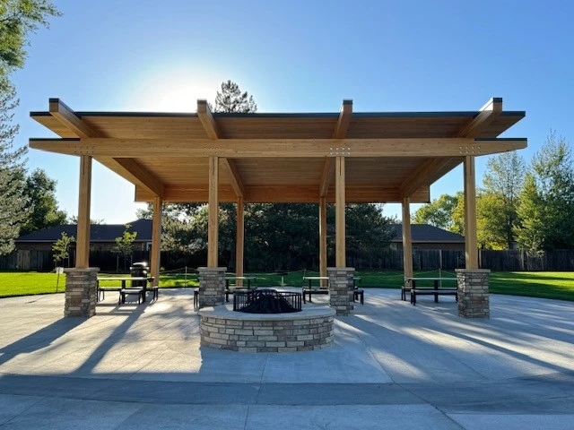
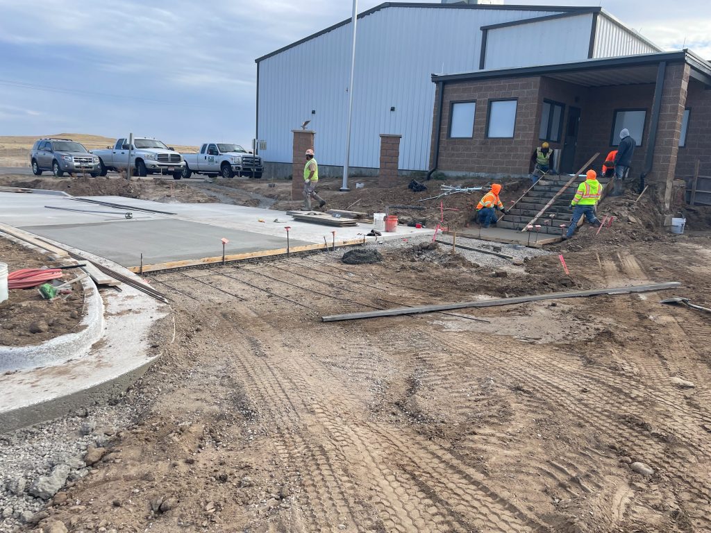
Municipal Services Engineering, Structural Engineering
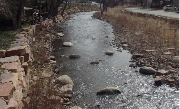
Calibre’s structural team worked on the revitalization of Berthoud Town Park, located in the heart...
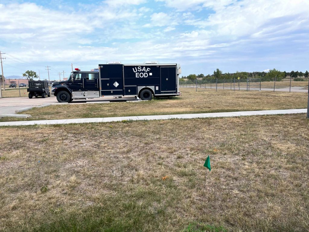
Aviation, Industrial & Storage
Calibre provided civil design services for an 11,619 square-foot Explosive Ordinance Disposal (EOD) Facility addition...
Civil Engineering, Federal Services Engineering, Structural Engineering
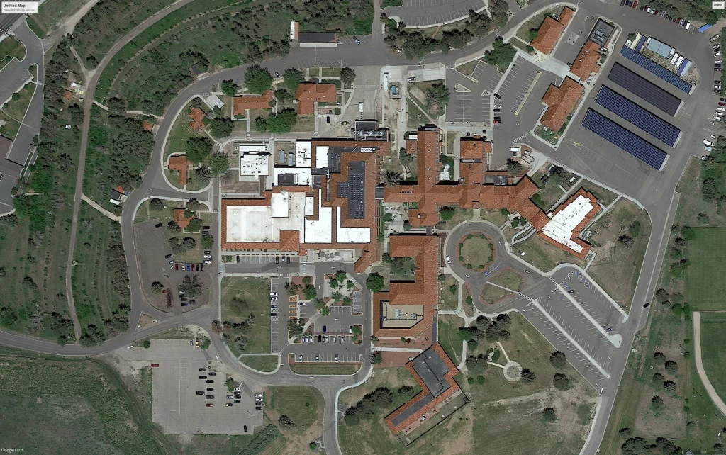
Healthcare & Research
Calibre worked on the expansion and reconfiguration of the Emergency Department (ED) and the creation...
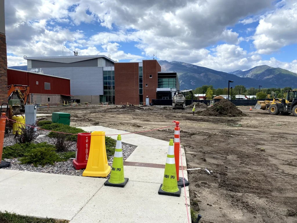
Located in the heart of the NIH campus, the newly constructed Building J Microscopy Facility...
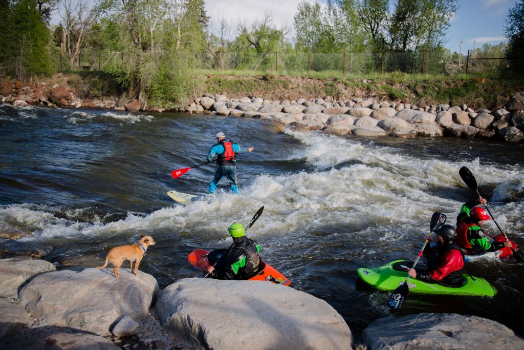
Whitewater & Rivers Engineering
Calibre’s Whitewater Team sought to enhance the Supply Irrigating Ditch Company’s diversion structure on St....
Water, Sewer & Storm Infrastructure
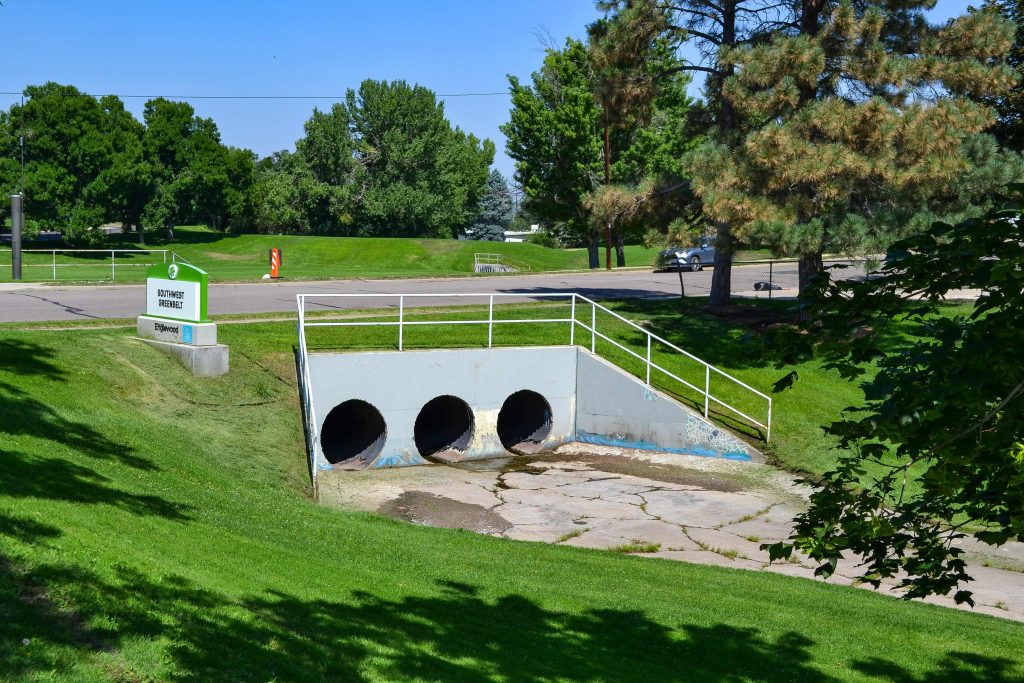
Calibre conducted a comprehensive assessment of a critical CMP and RCP stormwater pipe. The project...
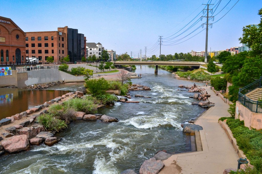
Civil Engineering, Water Resources Engineering, Whitewater & Rivers Engineering
Located in the heart of downtown Denver, the South Platte River Rehabilitation project spans one...
Civil Engineering, Construction Phase Services Engineering, Federal Services Engineering
Animal Welfare, Transportation & Parking
This project encompassed the repaving and construction of the parking lot, covering both the existing...
Civil Engineering, Construction Phase Services Engineering, Federal Services Engineering, Water Resources Engineering
Master Planned Development, Transportation & Parking, Water, Sewer & Storm Infrastructure
Calibre provided civil engineering services for the $28 million Phase 4 Expansion of the Dallas...
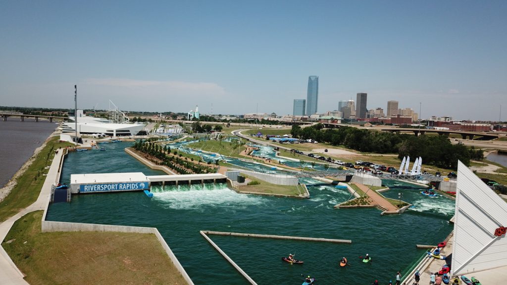
Riversport Rapids Whitewater Center is the first pumped-park globally to offer a recreational, a competition,...
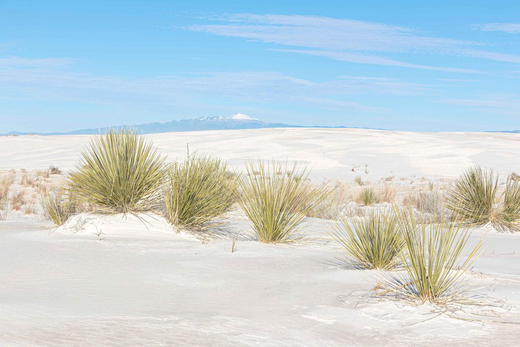
Aviation, Commercial / Office / Retail, Cultural & Religious Facilities, Parks & Recreation
Calibre worked on this rehabilitation project at the historic White Sands Visitor Center. Spanning 8,600...
Master Planned Development, Water, Sewer & Storm Infrastructure
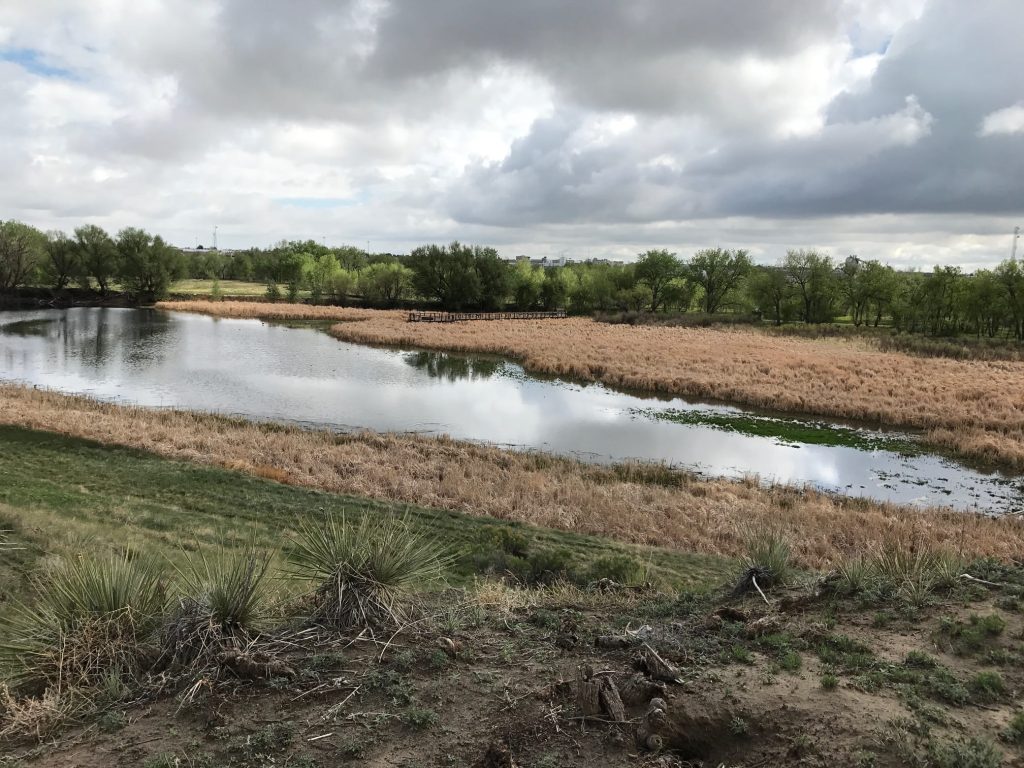
Calibre undertook a comprehensive stormwater master planning project for the 1,200-acre Original Aurora area in...
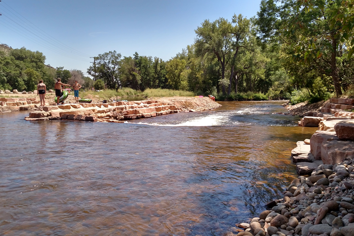
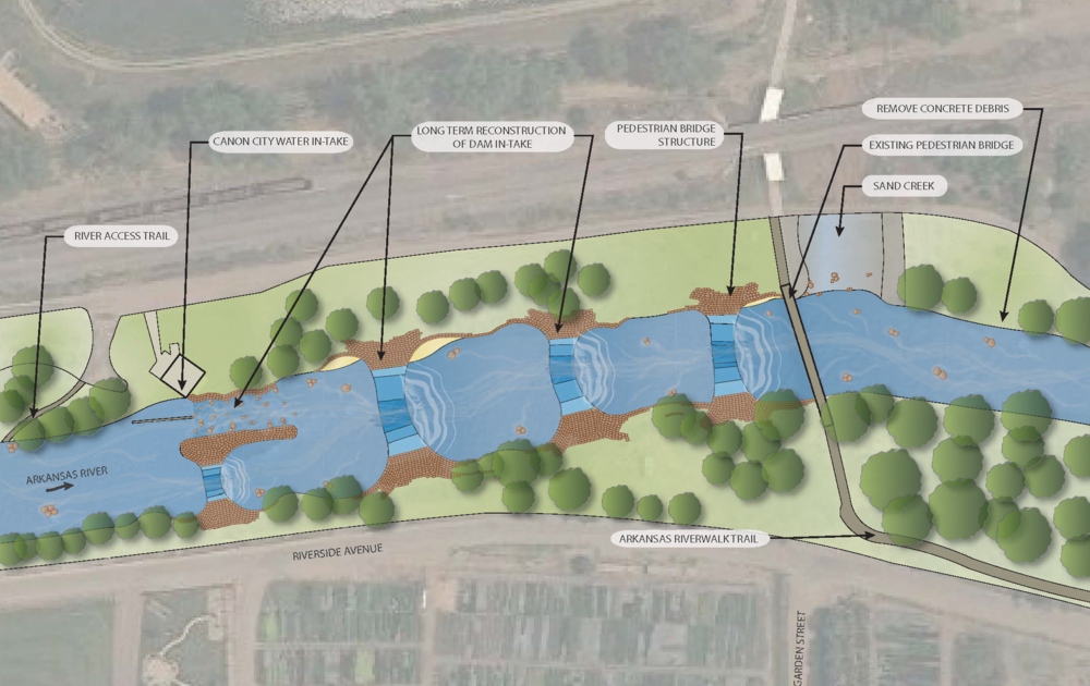
The Arkansas River is the main recreational attraction in Cañon City. Locals and visitors are...
The Grand Junction VA Medical Center project includes 50,000 square feet of infrastructure. Calibre delivered...
Eagle River Park is designed to attract summer visitors and promote outdoor recreation. Situated along...