Civil Engineering, Municipal Services Engineering, Water Resources Engineering
Municipal
Water, Sewer & Storm Infrastructure
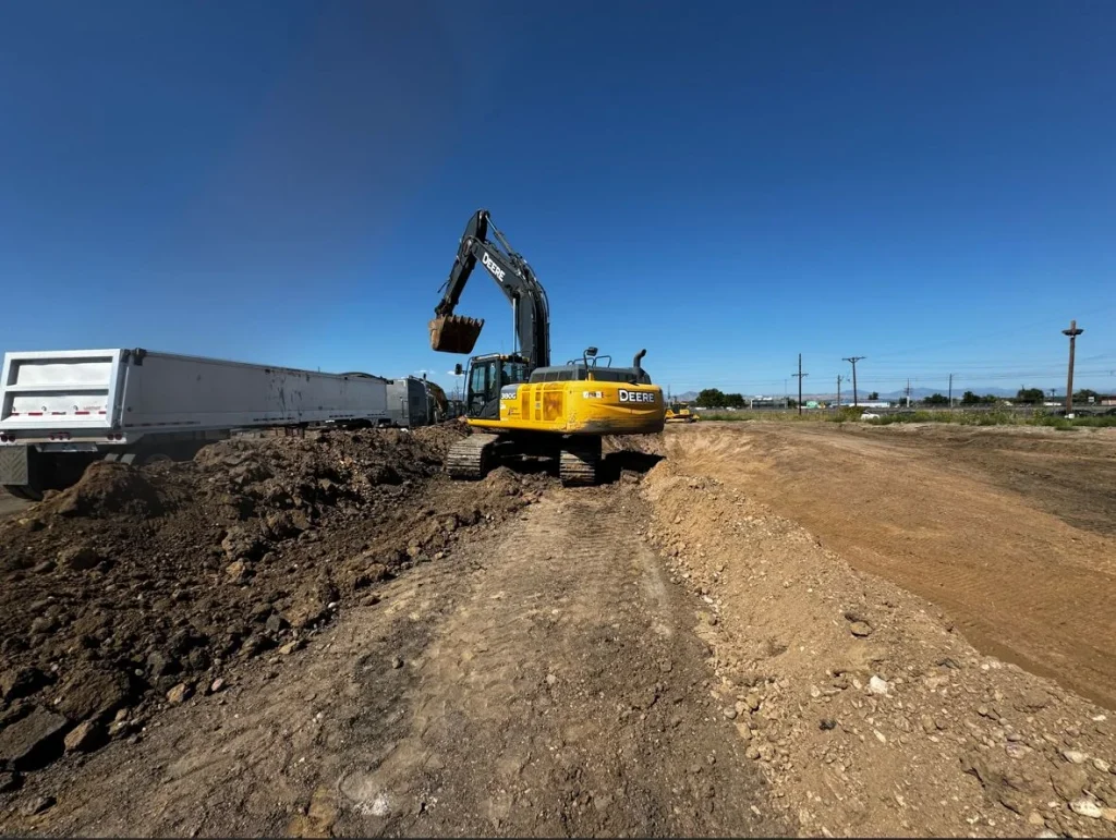
Calibre conducted a comprehensive assessment of a critical CMP and RCP stormwater pipe. The project...
Whitewater & Rivers Engineering
Parks & Recreation
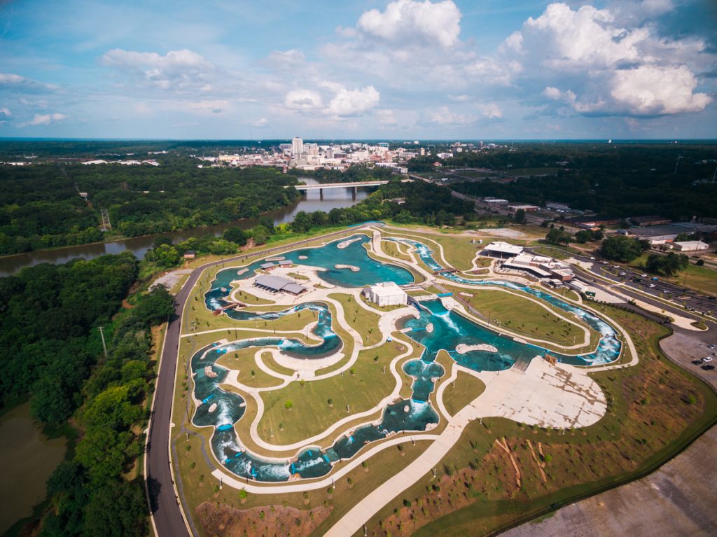
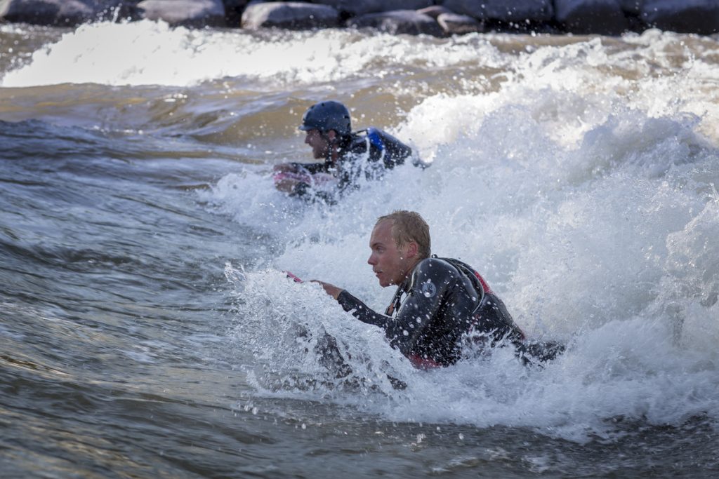
Nestled along the scenic Alabama River, Montgomery Whitewater spans over 100 acres and serves as...
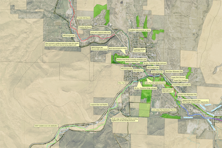
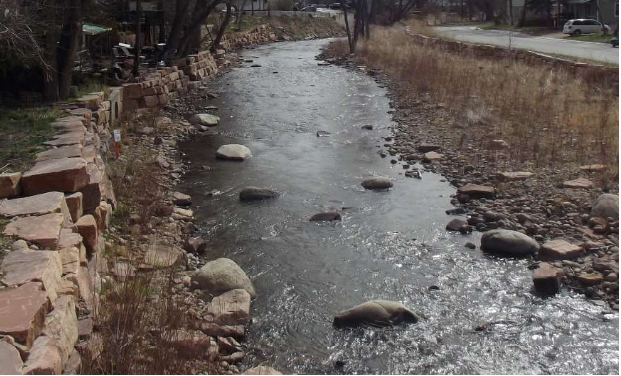
Calibre’s Whitewater Team led the restoration of the Town of Lyons’ park following the devastating...
Civil Engineering, Municipal Services Engineering
Mixed-Use & TOD, Residential
The I-25 Erie Gateway is a transformative 600-acre mixed-use development designed to be a vibrant,...
The Cañon City River Whitewater Park focused on revitalizing the river ecosystem while enhancing recreational...
Civil Engineering, Construction Phase Services Engineering, Federal Services Engineering
Federal & Military
Animal Welfare, Transportation & Parking
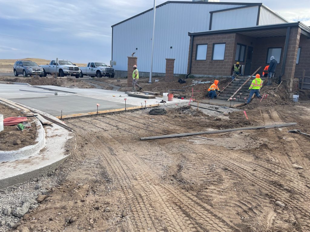
This project encompassed the repaving and construction of the parking lot, covering both the existing...
Civil Engineering, Water Resources Engineering, Whitewater & Rivers Engineering
Private
Master Planned Development, Parks & Recreation
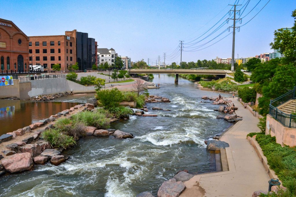
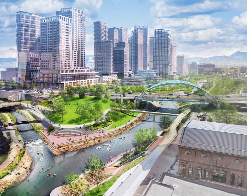
Located in the heart of downtown Denver, the South Platte River Rehabilitation project spans one...
International
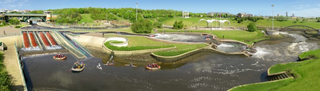
The Tees Barrage International White Water Centre is a groundbreaking project that showcases our commitment...
Municipal Services Engineering
Parks & Recreation, Transportation & Parking
Calibre undertook the conceptual layout and cost estimation for a pivotal bridge extending from the...
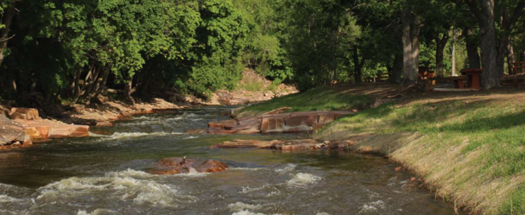
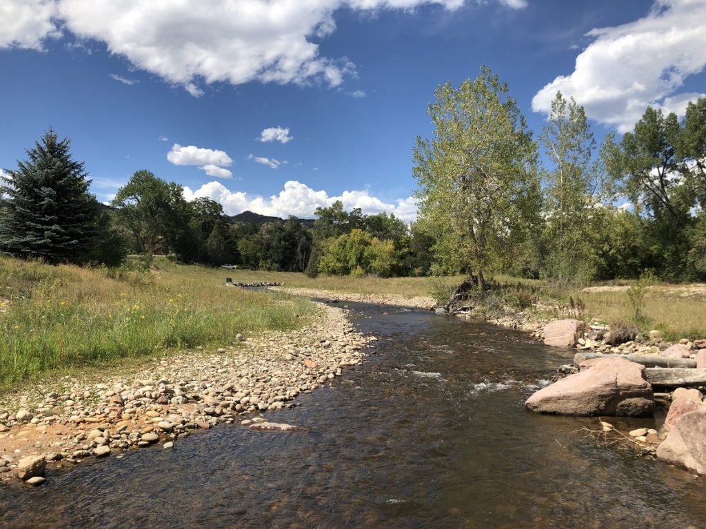
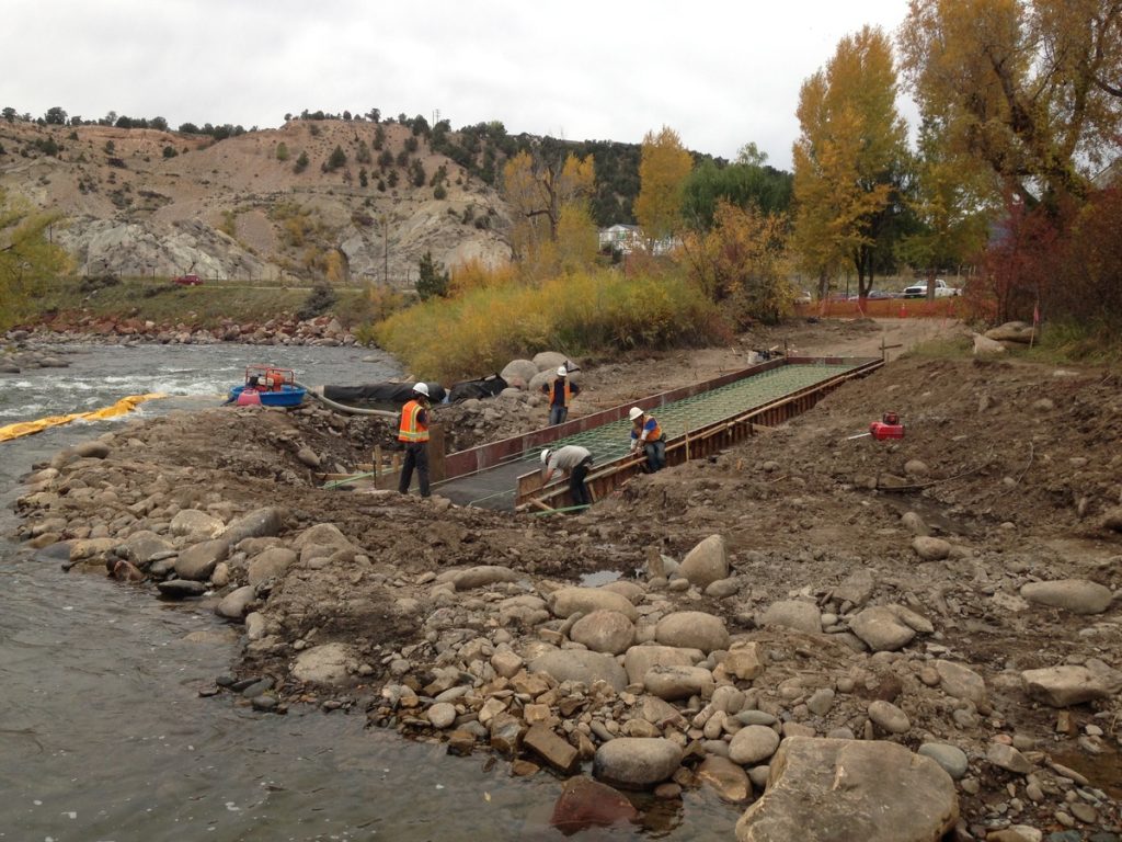
The 2013 Colorado Flood washed away approximately 3,600 square feet of riverfront property of a...
Civil Engineering, Federal Services Engineering, Water Resources Engineering
Parks & Recreation, Water, Sewer & Storm Infrastructure
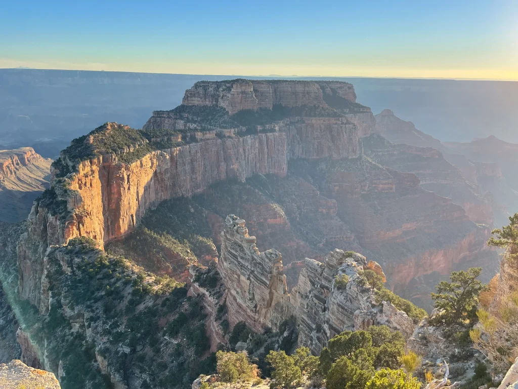
Located in the picturesque North Rim area, this extensive infrastructure project spans vital water and...
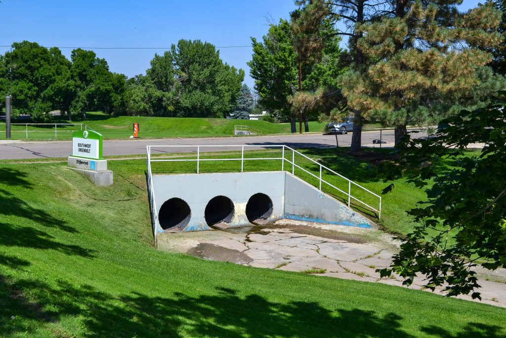
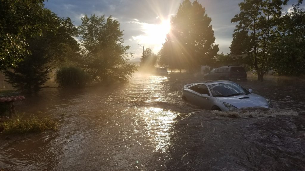
In July 2018, Englewood faced unprecedented 100-year flooding events that severely impacted three major basins,...
Municipal Services Engineering, Whitewater & Rivers Engineering
Calibre’s Whitewater Team played a pivotal role in the development of the South Saint Vrain...
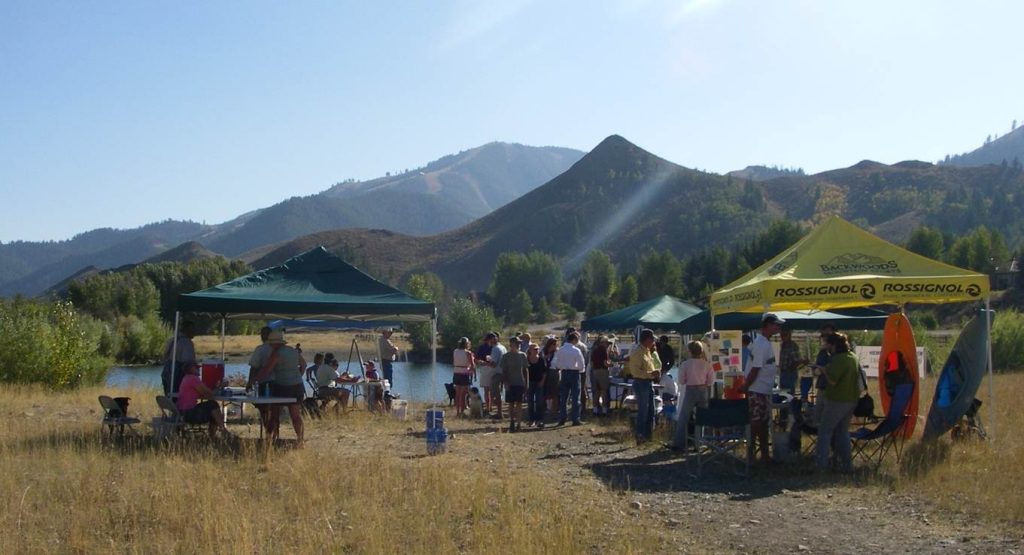
Calibre’s Whitewater Team led the development of the River Park Master Plan in Ketchum, Idaho,...
Civil Engineering, Federal Services Engineering, Structural Engineering
Healthcare & Research
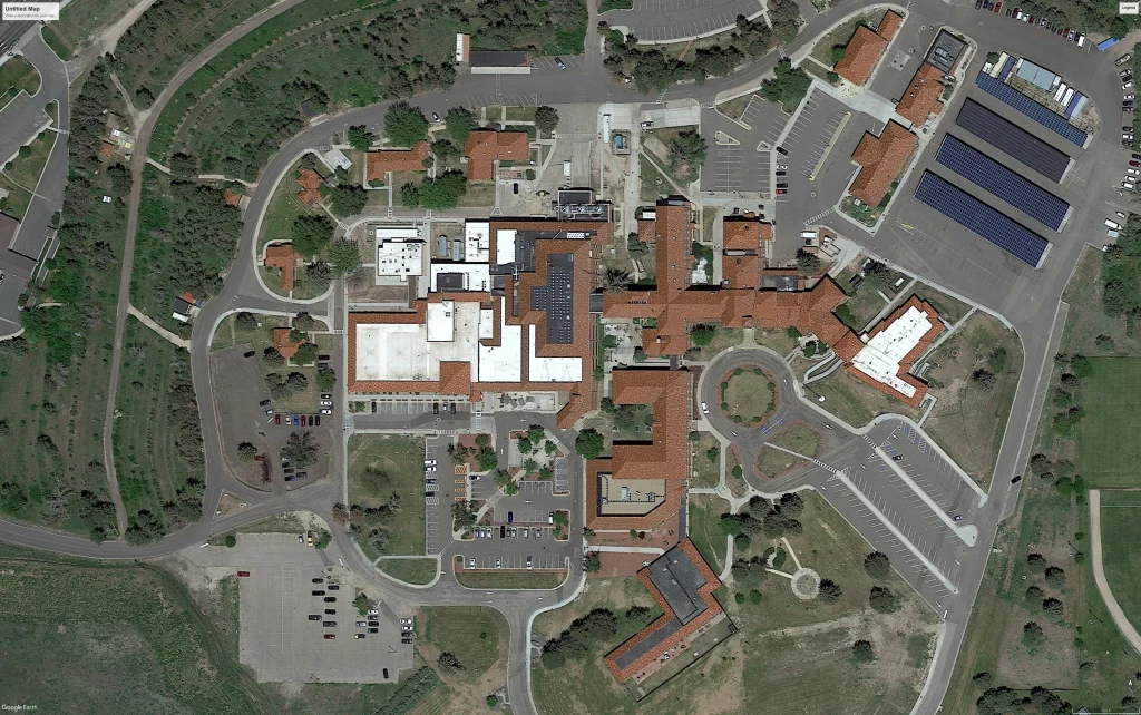
Calibre worked on the expansion and reconfiguration of the Emergency Department (ED) and the creation...
Civil Engineering, Construction Phase Services Engineering
Auto & Maintenance
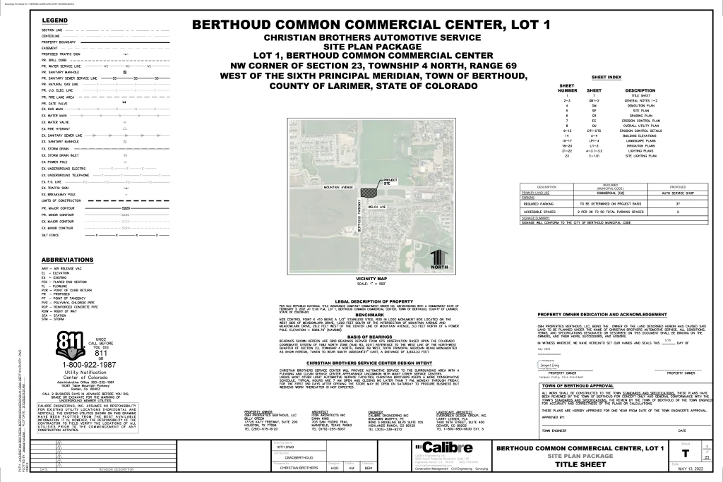
Located at the southeast corner of Mountain Avenue and Berthoud Parkway in Larimer County, Colorado,...
Civil Engineering, Construction Phase Services Engineering, Structural Engineering, Water Resources Engineering, Whitewater & Rivers Engineering
Commercial / Office / Retail, Master Planned Development, Mixed-Use & TOD, Parks & Recreation, Residential, Transportation & Parking, Water, Sewer & Storm Infrastructure
Situated in the vibrant heart of Downtown Denver, Calibre is proud to contribute to a...
The Town of Eagle Visitors Center Boat Launch was constructed in the fall of 2015...
Calibre’s Whitewater Team played a key role in the successful recovery project following the devastating...