Civil Engineering, Federal Services Engineering
Federal & Military
Healthcare & Research
Located in the heart of the NIH campus, the newly constructed Building J Microscopy Facility...
Civil Engineering, Federal Services Engineering, Structural Engineering
Calibre worked on the expansion and reconfiguration of the Emergency Department (ED) and the creation...
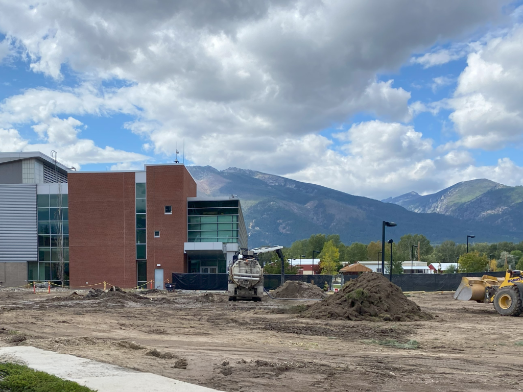
The Grand Junction VA Medical Center project includes 50,000 square feet of infrastructure. Calibre delivered...
Civil Engineering
Private
Aviation, Master Planned Development, Mixed-Use & TOD
Calibre is providing civil engineering services, including due diligence, site planning, and infrastructure design for...
Whitewater & Rivers Engineering
Municipal
Parks & Recreation
Calibre’s Whitewater Team collaborated with McMillen Associates, the City of Boise, and Farmer’s Union Diversion...
Cultural & Religious Facilities, Parks & Recreation, Residential, Water, Sewer & Storm Infrastructure
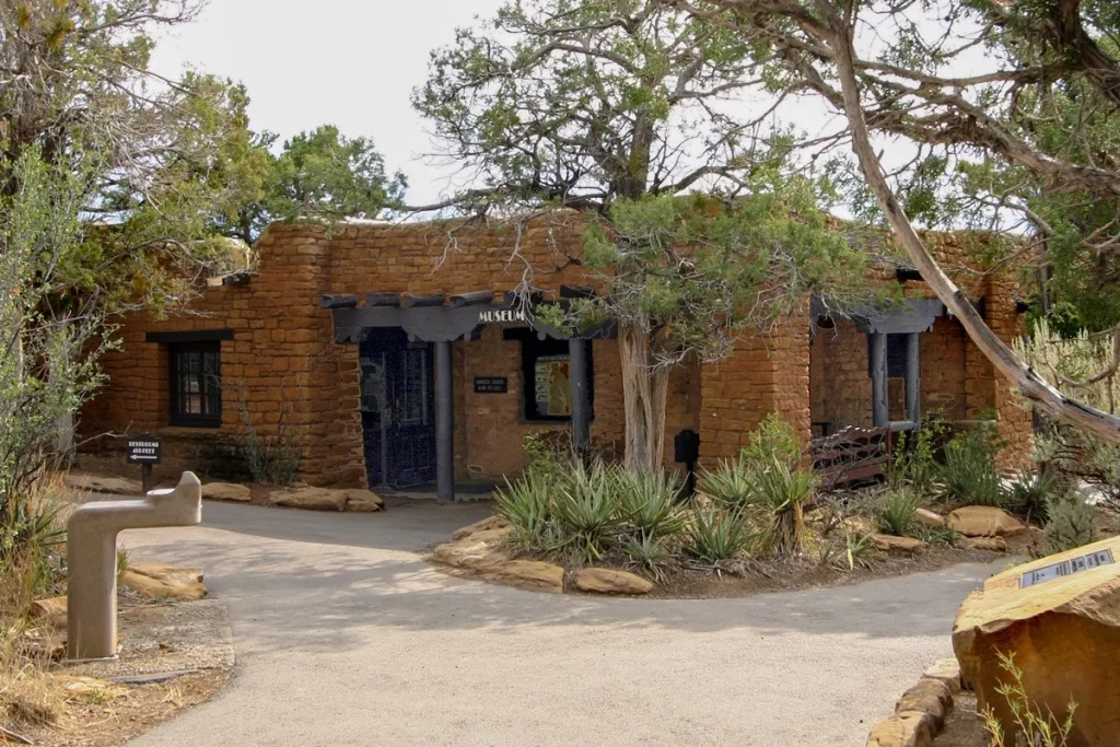
Located within the historic Chapin Mesa Historic Buildings and National Historic Landmark District, this significant...
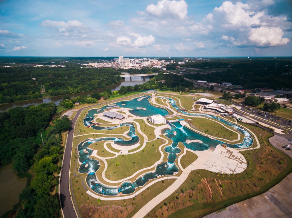
Nestled along the scenic Alabama River, Montgomery Whitewater spans over 100 acres and serves as...
Civil Engineering, Municipal Services Engineering, Water Resources Engineering
Master Planned Development, Parks & Recreation, Water, Sewer & Storm Infrastructure
The Jackass Gulch project encompasses approximately 1,000 acres of critical watershed management. Calibre was contracted...
International
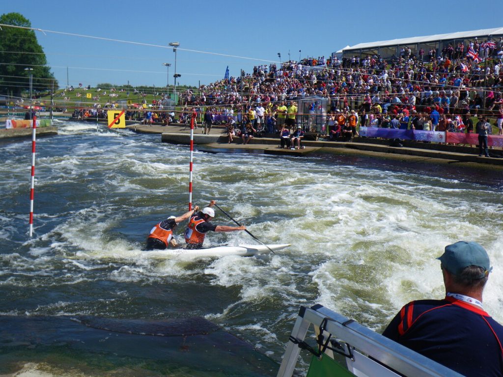
The Holme Pierrepont National Watersports Centre is a premier facility that underwent a transformative upgrade...
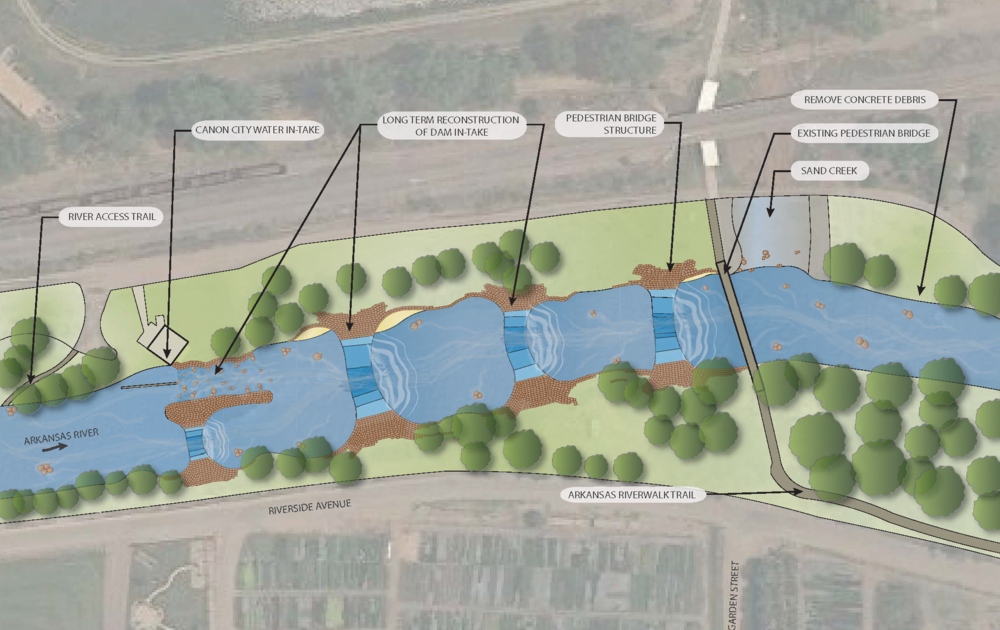
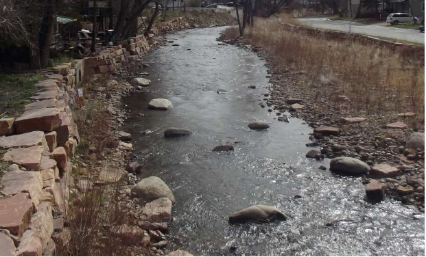
The Arkansas River is the main recreational attraction in Cañon City. Locals and visitors are...
Cultural & Religious Facilities, Transportation & Parking, Water, Sewer & Storm Infrastructure
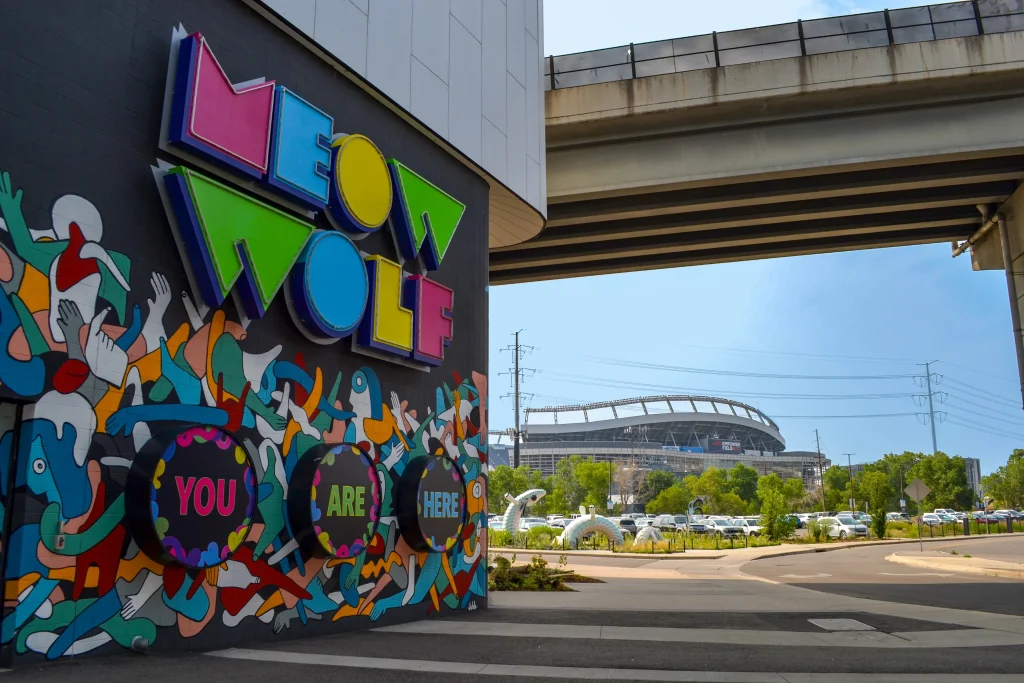
Calibre provided civil engineering services for the Meow Wolf building in Denver, Colorado, covering 90,000...
Aviation, Commercial / Office / Retail, Cultural & Religious Facilities, Parks & Recreation
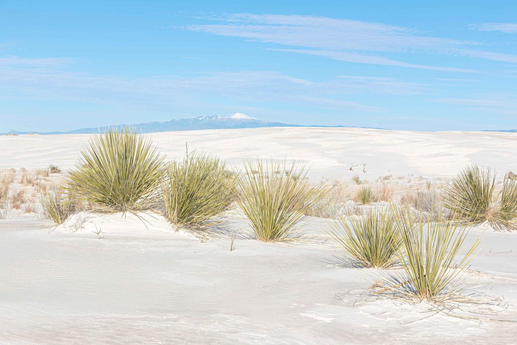
Calibre worked on this rehabilitation project at the historic White Sands Visitor Center. Spanning 8,600...
Federal Services Engineering, Structural Engineering
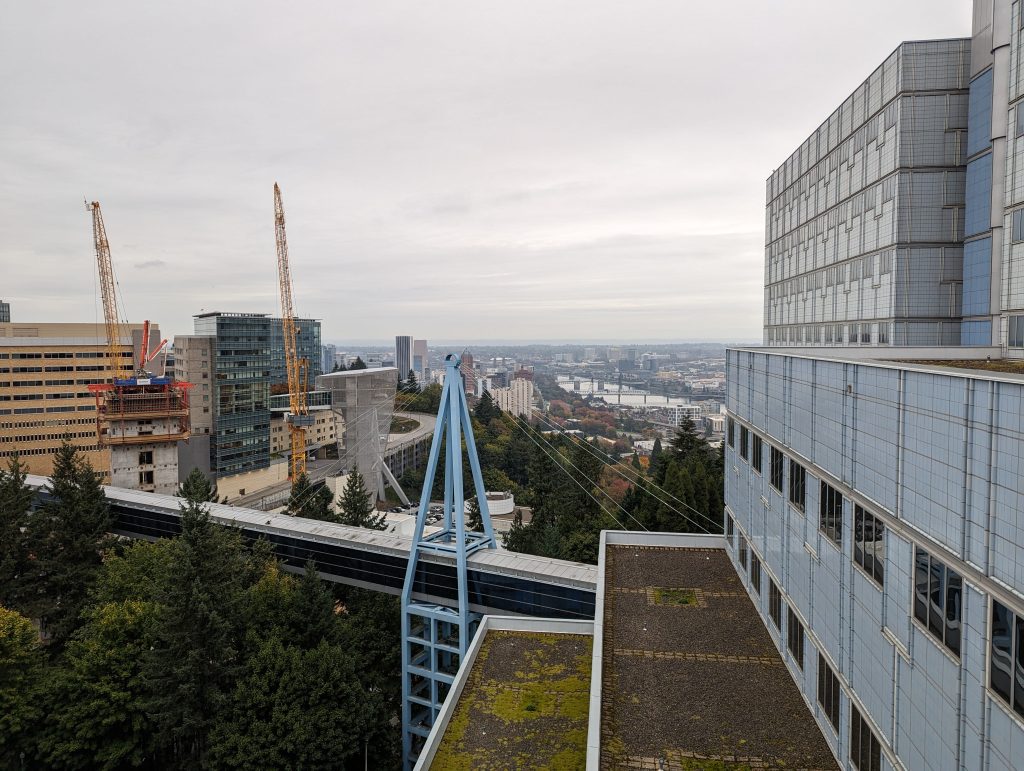
Calibre provided structural engineering services for the VA Portland Healthcare System, located in Portland, Oregon....
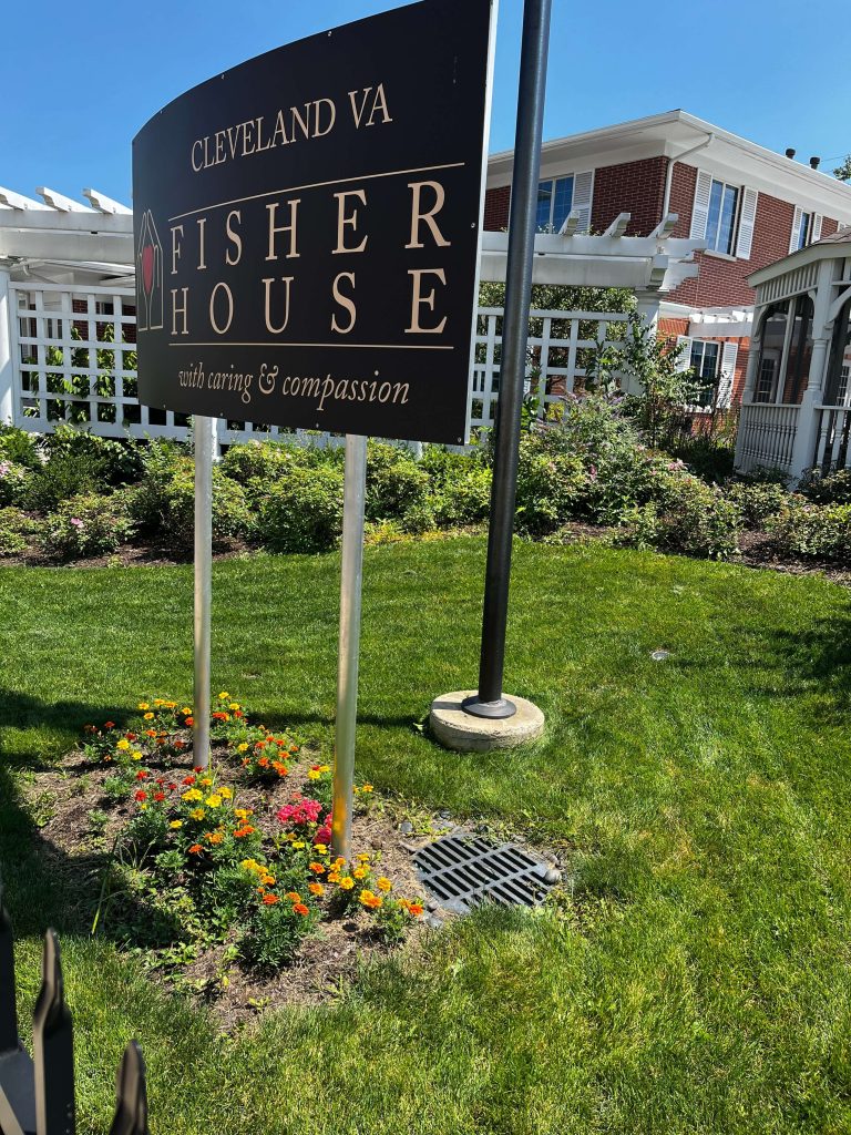
Calibre completed a comprehensive assessment of the storm sewer system for the Louis Stokes Cleveland...
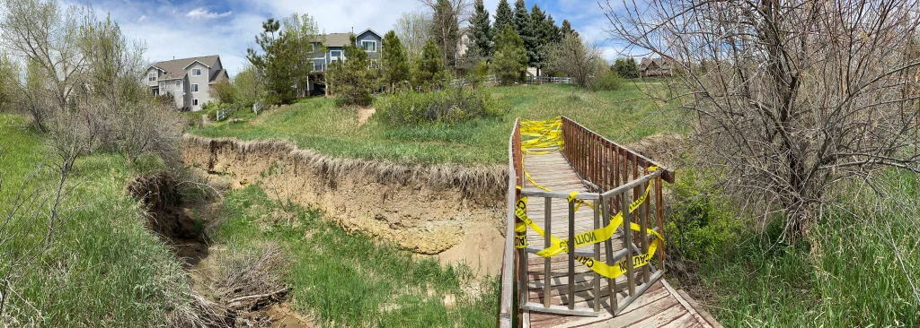
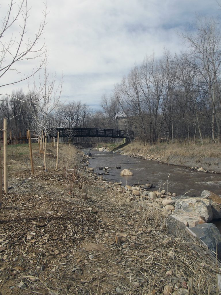
Bohn Park suffered extensive damage from the 2013 Colorado Flood, which caused record rainfall to...
Calibre’s Whitewater Team led the restoration of the Town of Lyons’ park following the devastating...
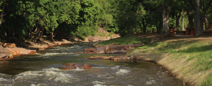
The Durango Whitewater Park is one of the country’s most utilized whitewater parks. Calibre’s Whitewater...
Master Planned Development, Transportation & Parking, Water, Sewer & Storm Infrastructure
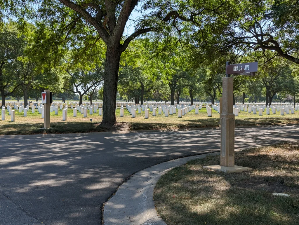
Calibre provided civil engineering services for the Fort Snelling National Cemetery, located in Minneapolis-Saint Paul,...
Civil Engineering, Municipal Services Engineering
Transportation & Parking, Water, Sewer & Storm Infrastructure
Calibre served as the on-call civil engineer for the City of Muncie, Indiana, overseeing a...
Municipal Services Engineering, Whitewater & Rivers Engineering
Calibre’s Whitewater Team played a key role in the successful recovery project following the devastating...