Civil Engineering, Federal Services Engineering, Structural Engineering
Federal & Military
Aviation, Commercial / Office / Retail, Cultural & Religious Facilities, Parks & Recreation
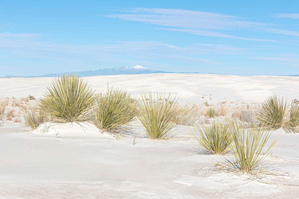
Calibre worked on this rehabilitation project at the historic White Sands Visitor Center. Spanning 8,600...
Civil Engineering
Private
Master Planned Development, Residential
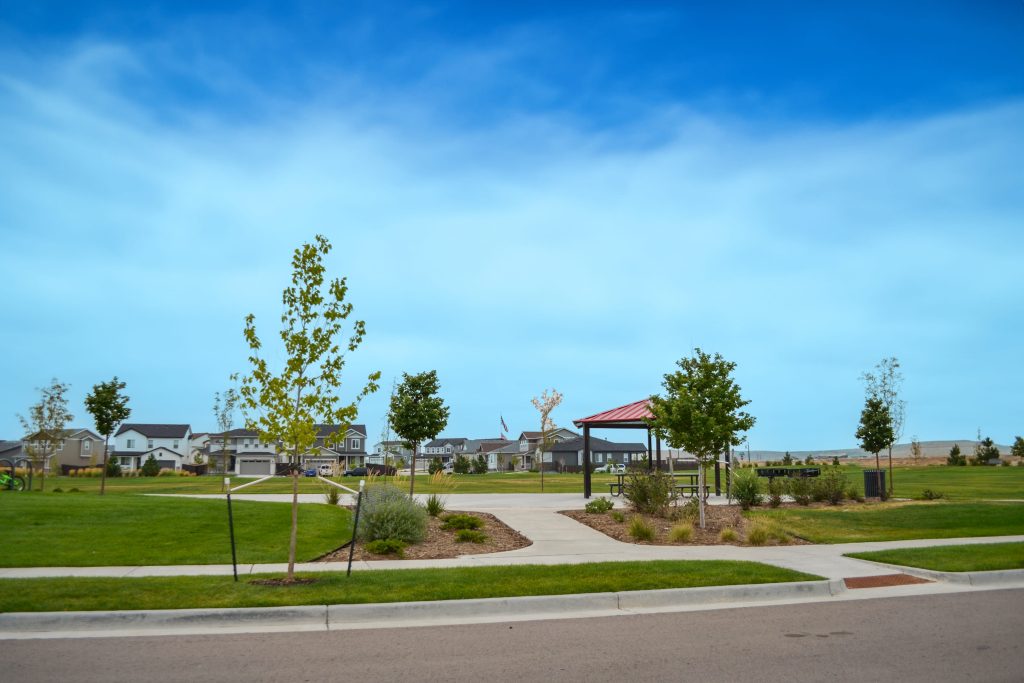
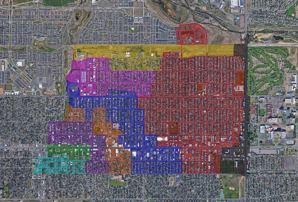
Located in Commerce City, the Settlers Crossing project encompasses 163.39 acres and features 120 single-family...
Civil Engineering, Construction Phase Services Engineering
Auto & Maintenance
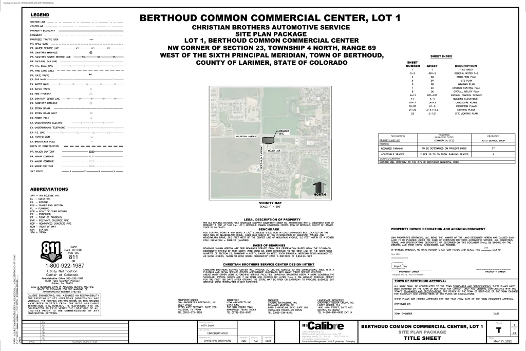
Located at the southeast corner of Mountain Avenue and Berthoud Parkway in Larimer County, Colorado,...
Master Planned Development, Transportation & Parking, Water, Sewer & Storm Infrastructure
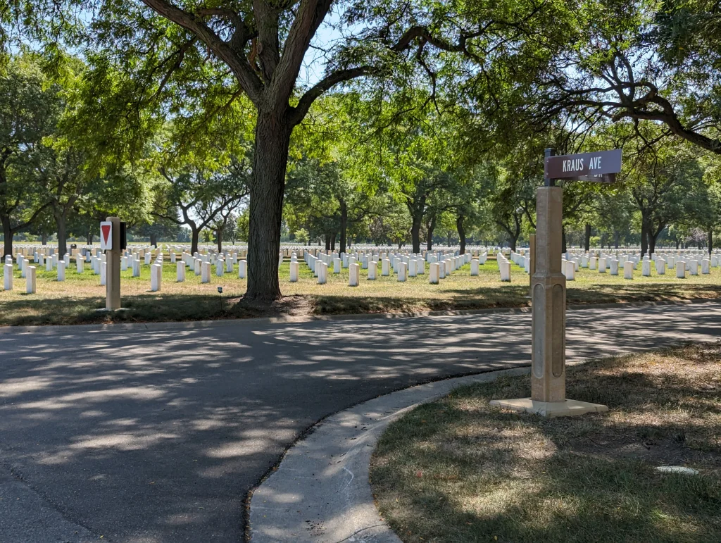
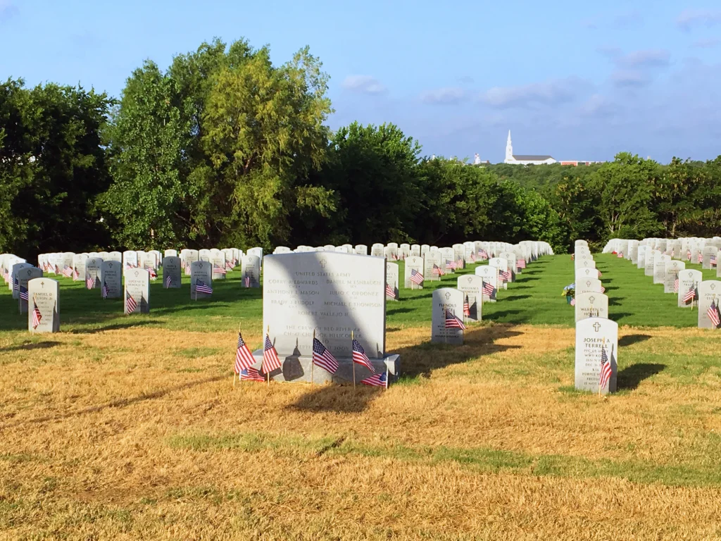
Calibre provided civil engineering services for the Fort Snelling National Cemetery, located in Minneapolis-Saint Paul,...
Civil Engineering, Construction Phase Services Engineering, Federal Services Engineering, Water Resources Engineering
Calibre provided civil engineering services for the $28 million Phase 4 Expansion of the Dallas...
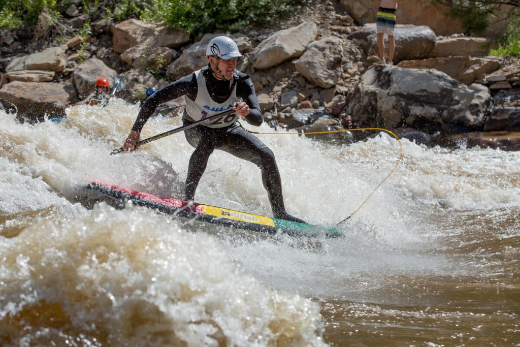
Whitewater & Rivers Engineering
International
Parks & Recreation
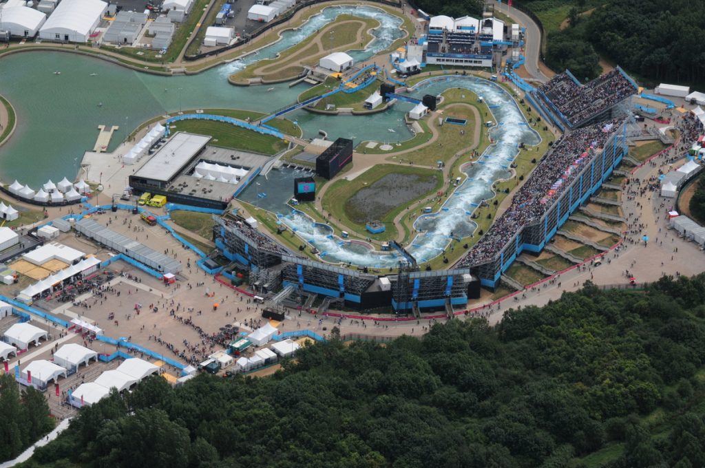
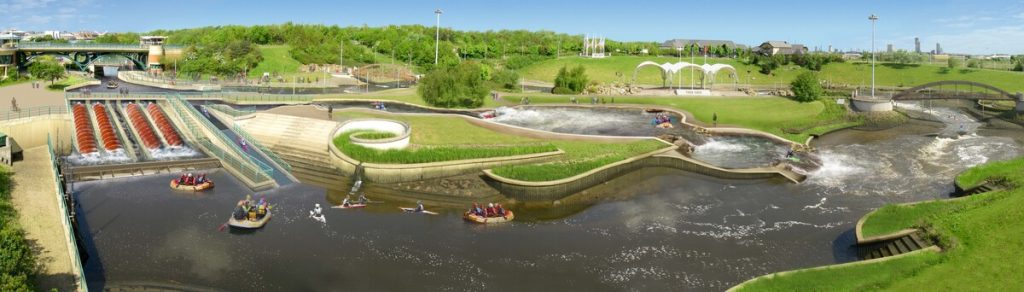
Calibre’s Whitewater Team proudly contributed to the Lee Valley Whitewater Centre, the iconic venue for...
Municipal
Eagle River Park is designed to attract summer visitors and promote outdoor recreation. Situated along...
Municipal Services Engineering, Whitewater & Rivers Engineering
Calibre’s Whitewater Team played a key role in the successful recovery project following the devastating...
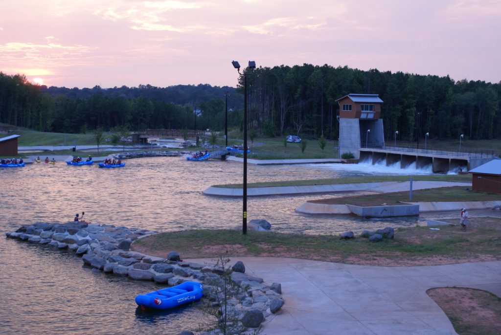
The National Whitewater Center is the largest and most profitable whitewater park of its kind...
Civil Engineering, Municipal Services Engineering, Water Resources Engineering
Parks & Recreation, Water, Sewer & Storm Infrastructure
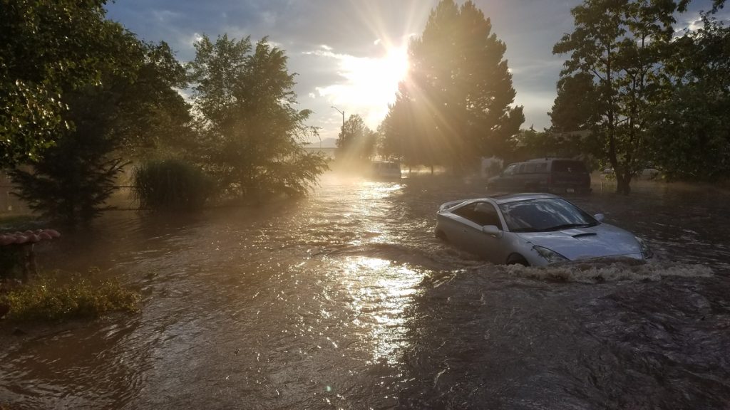
In July 2018, Englewood faced unprecedented 100-year flooding events that severely impacted three major basins,...
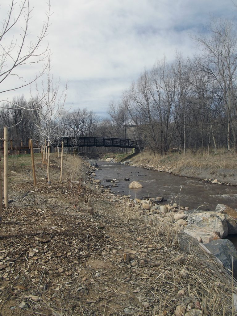
The 2013 Colorado Flood washed away approximately 3,600 square feet of riverfront property of a...
Calibre’s Whitewater Team led the restoration of the Town of Lyons’ park following the devastating...
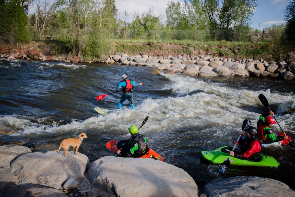
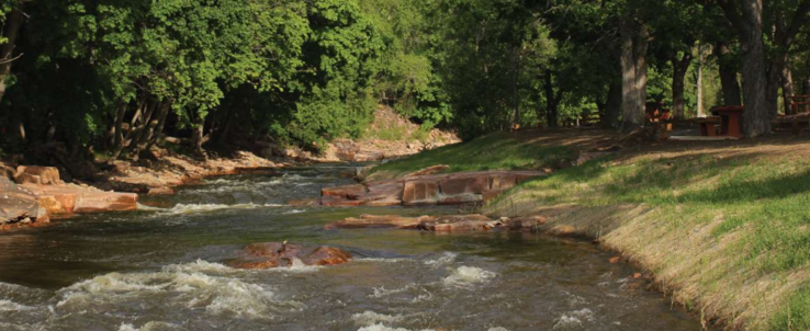
The Durango Whitewater Park is one of the country’s most utilized whitewater parks. Calibre’s Whitewater...
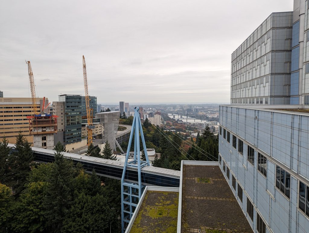
Federal Services Engineering, Structural Engineering
Healthcare & Research
Calibre provided structural engineering services for the VA Portland Healthcare System, located in Portland, Oregon....
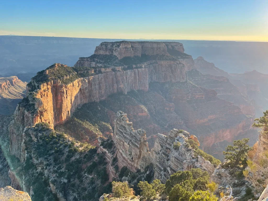
Civil Engineering, Federal Services Engineering, Water Resources Engineering
Located in the picturesque North Rim area, this extensive infrastructure project spans vital water and...
Bohn Park suffered extensive damage from the 2013 Colorado Flood, which caused record rainfall to...
Master Planned Development, Water, Sewer & Storm Infrastructure
Calibre Engineering collaborated with AECOM on a transformative Wastewater Master Plan for the City of...
Civil Engineering, Federal Services Engineering
Cultural & Religious Facilities, Parks & Recreation, Residential, Water, Sewer & Storm Infrastructure
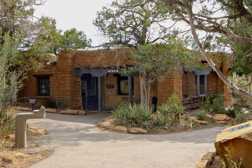
Located within the historic Chapin Mesa Historic Buildings and National Historic Landmark District, this significant...
The Tees Barrage International White Water Centre is a groundbreaking project that showcases our commitment...
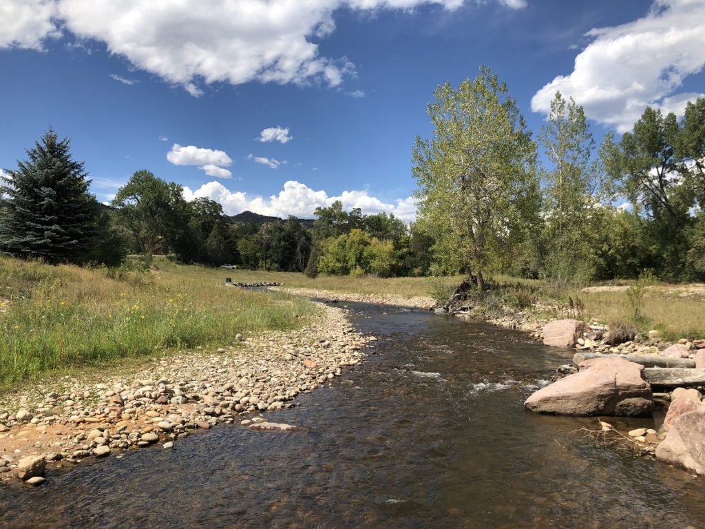
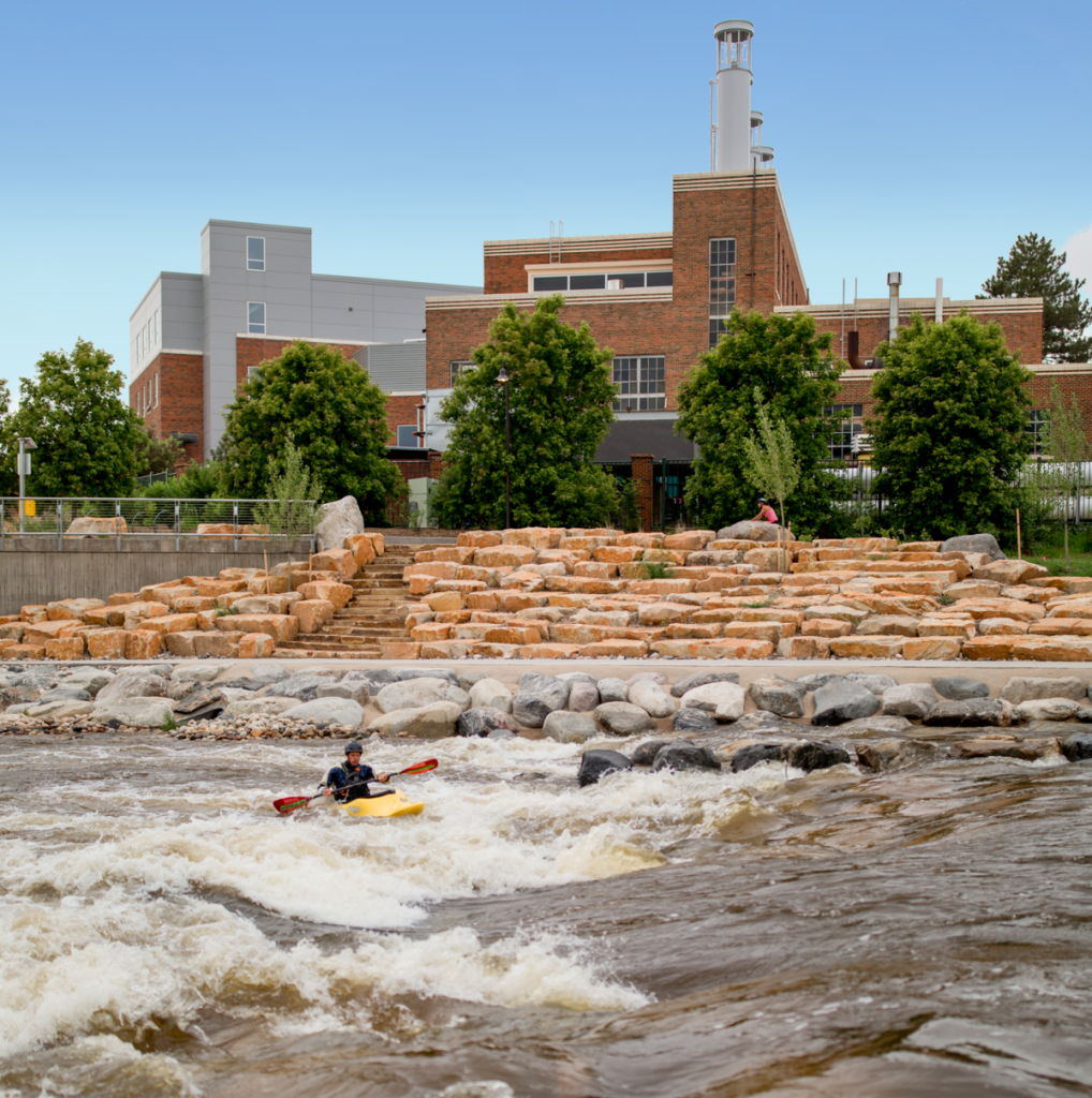
The Poudre River Park was developed to transform an abandoned diversion structure into a vibrant...