Civil Engineering, Water Resources Engineering, Whitewater & Rivers Engineering
Private
Master Planned Development, Parks & Recreation
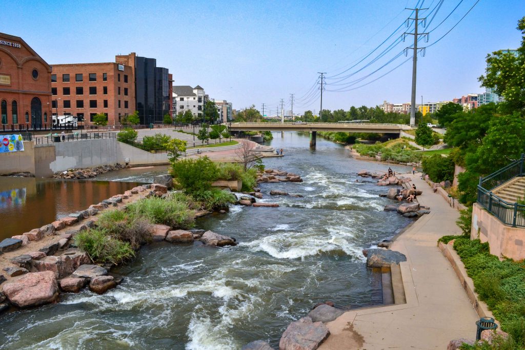
Located in the heart of downtown Denver, the South Platte River Rehabilitation project spans one...
Municipal Services Engineering, Whitewater & Rivers Engineering
Municipal
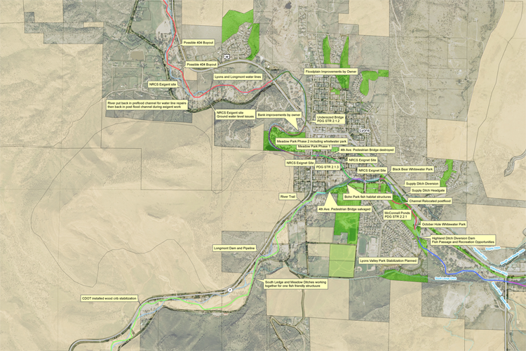
Calibre’s Whitewater Team played a pivotal role in the development of the South Saint Vrain...
Civil Engineering, Federal Services Engineering, Structural Engineering
Federal & Military
Healthcare & Research
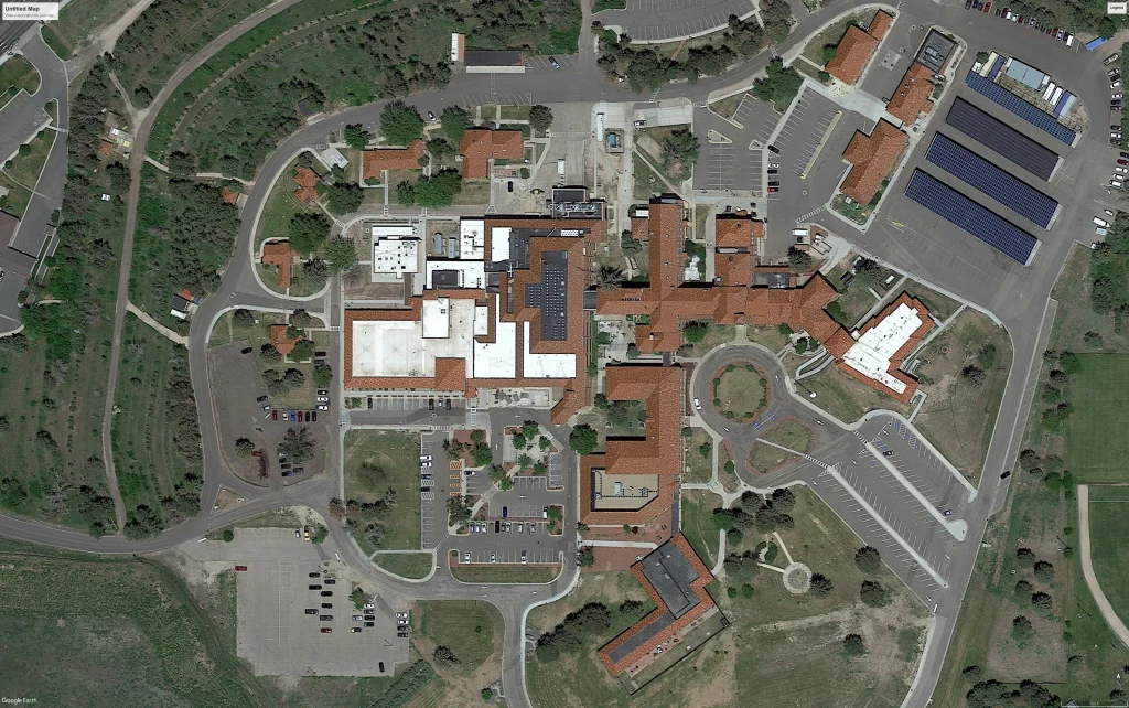
Calibre worked on the expansion and reconfiguration of the Emergency Department (ED) and the creation...
Civil Engineering, Construction Phase Services Engineering
Auto & Maintenance
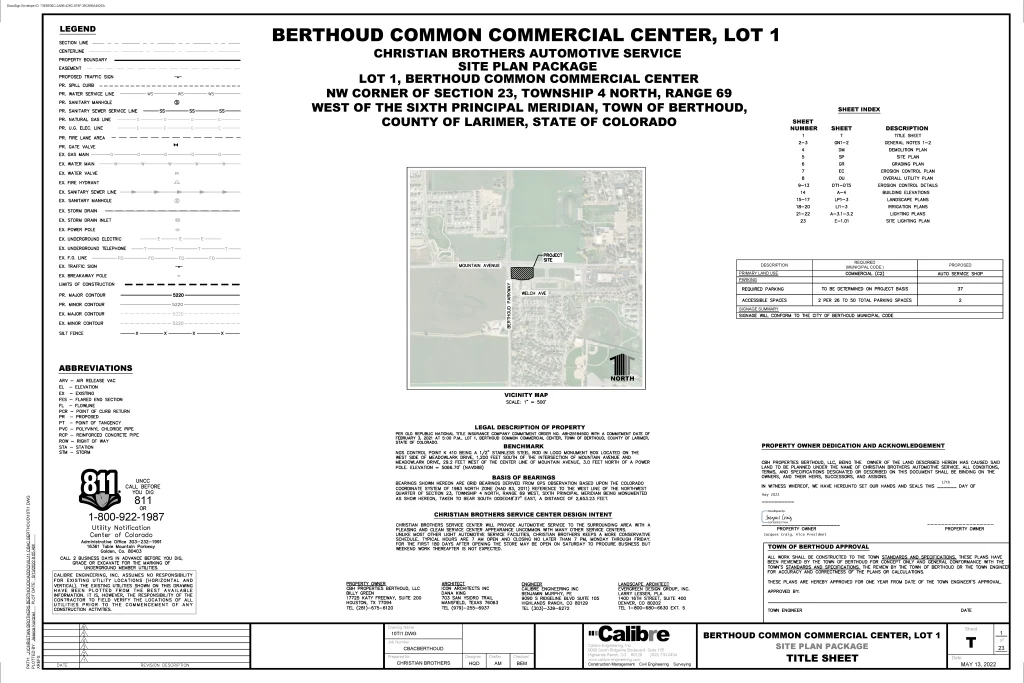
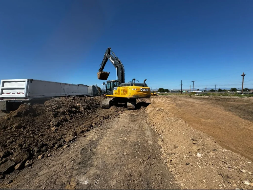
Located at the southeast corner of Mountain Avenue and Berthoud Parkway in Larimer County, Colorado,...
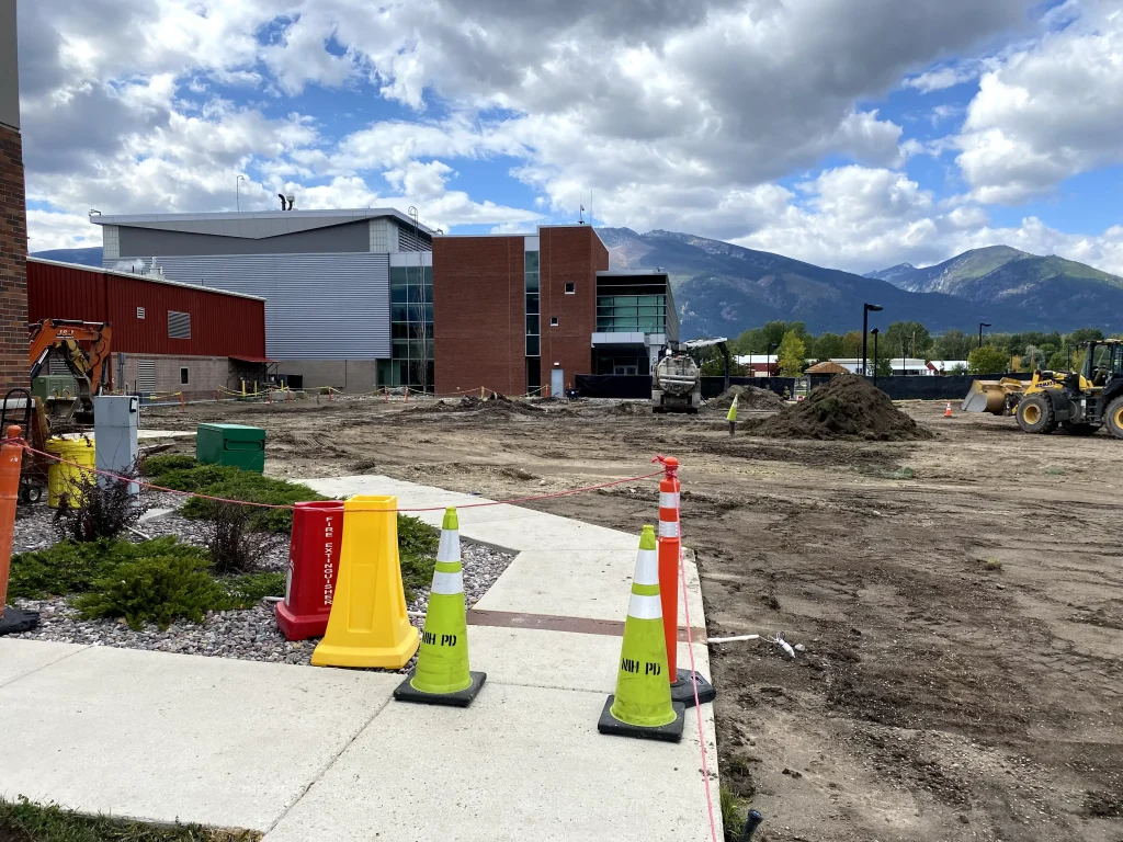
Civil Engineering, Federal Services Engineering
Located in the heart of the NIH campus, the newly constructed Building J Microscopy Facility...
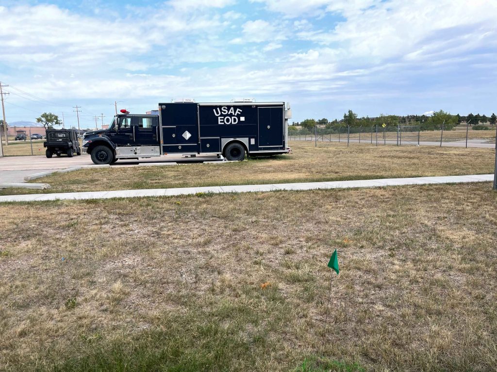
Aviation, Industrial & Storage
Calibre provided civil design services for an 11,619 square-foot Explosive Ordinance Disposal (EOD) Facility addition...
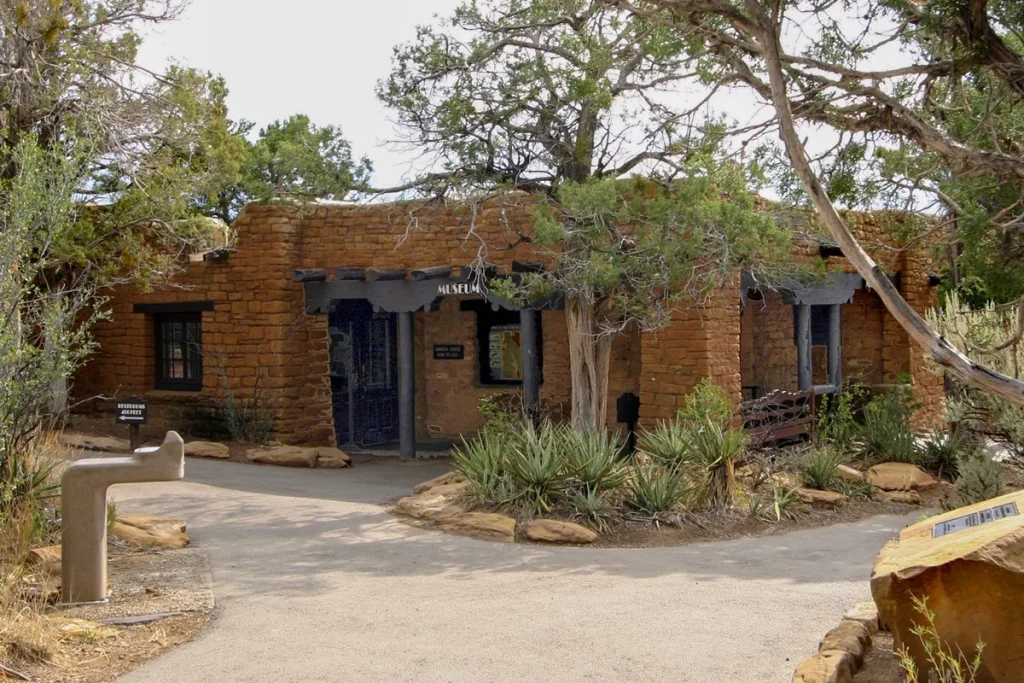
Cultural & Religious Facilities, Parks & Recreation, Residential, Water, Sewer & Storm Infrastructure
Located within the historic Chapin Mesa Historic Buildings and National Historic Landmark District, this significant...
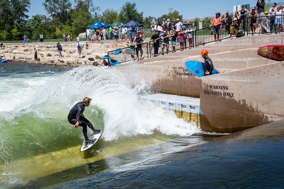
Whitewater & Rivers Engineering
Parks & Recreation
Calibre’s Whitewater Team collaborated with McMillen Associates, the City of Boise, and Farmer’s Union Diversion...
Municipal Services Engineering
Parks & Recreation, Transportation & Parking
Calibre undertook the conceptual layout and cost estimation for a pivotal bridge extending from the...
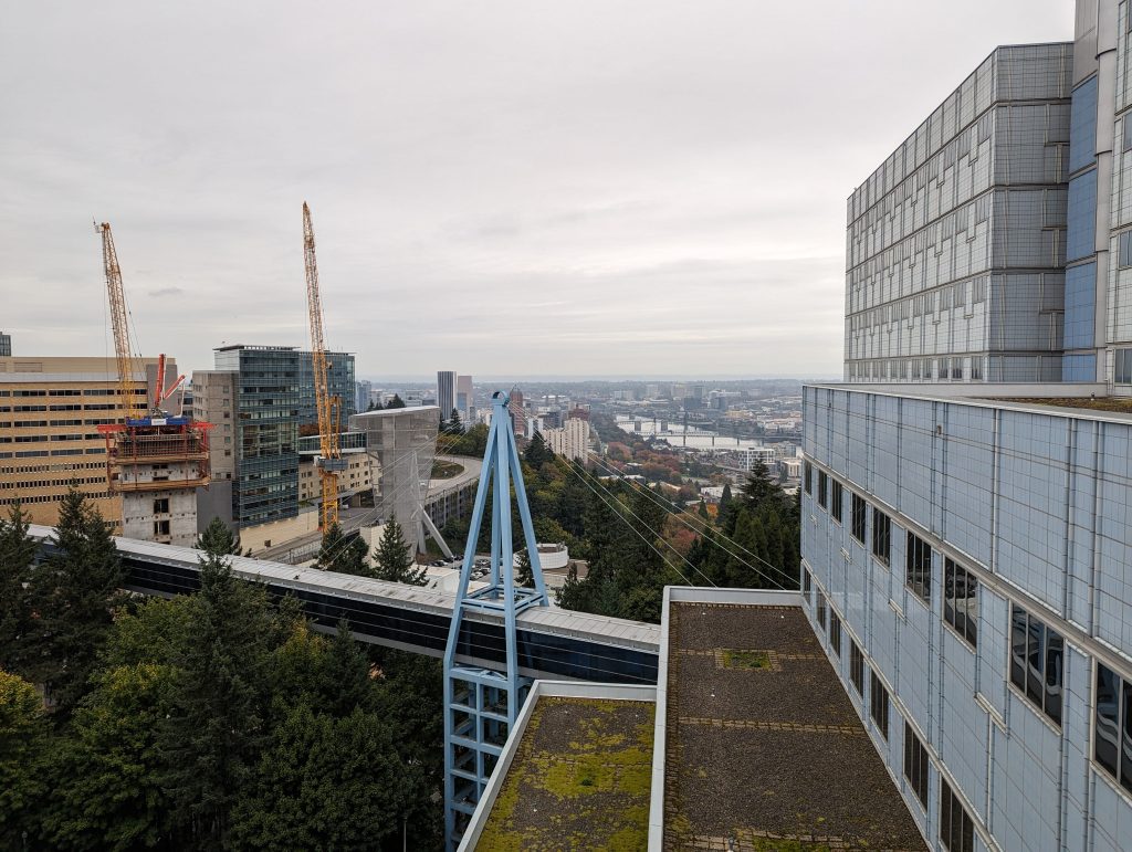
Federal Services Engineering, Structural Engineering
Calibre provided structural engineering services for the VA Portland Healthcare System, located in Portland, Oregon....
Civil Engineering, Municipal Services Engineering
Mixed-Use & TOD, Residential
The I-25 Erie Gateway is a transformative 600-acre mixed-use development designed to be a vibrant,...
Civil Engineering, Construction Phase Services Engineering, Federal Services Engineering, Water Resources Engineering
Master Planned Development, Transportation & Parking, Water, Sewer & Storm Infrastructure
Calibre provided civil engineering services for the $28 million Phase 4 Expansion of the Dallas...
Civil Engineering, Municipal Services Engineering, Water Resources Engineering
Master Planned Development, Parks & Recreation, Water, Sewer & Storm Infrastructure
The Jackass Gulch project encompasses approximately 1,000 acres of critical watershed management. Calibre was contracted...
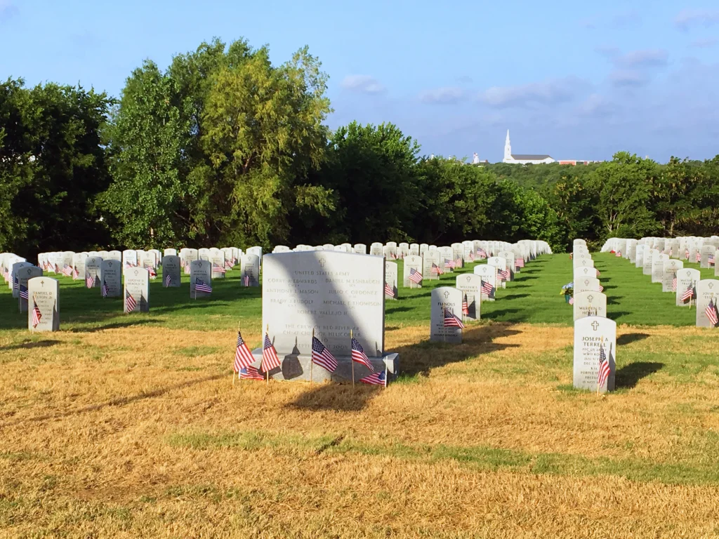
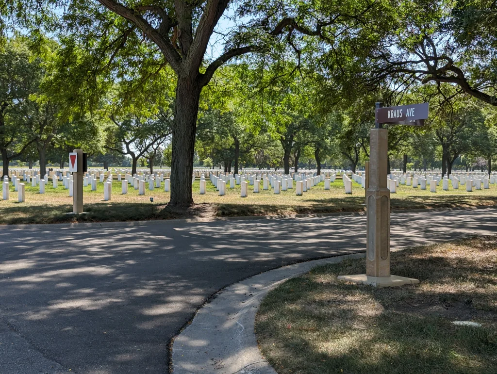
Calibre provided civil engineering services for the Fort Snelling National Cemetery, located in Minneapolis-Saint Paul,...
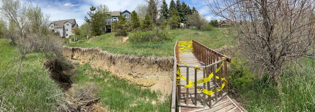
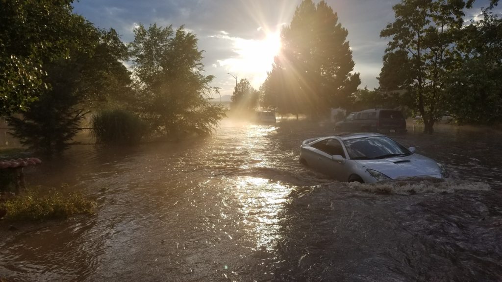
Parks & Recreation, Water, Sewer & Storm Infrastructure
In July 2018, Englewood faced unprecedented 100-year flooding events that severely impacted three major basins,...
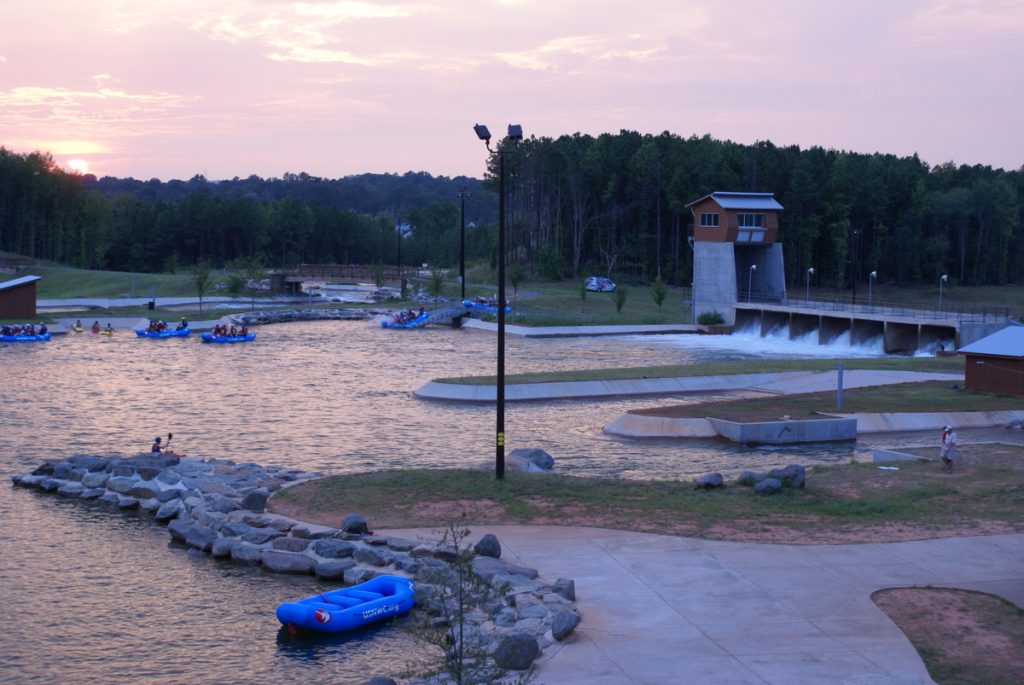
The National Whitewater Center is the largest and most profitable whitewater park of its kind...
International
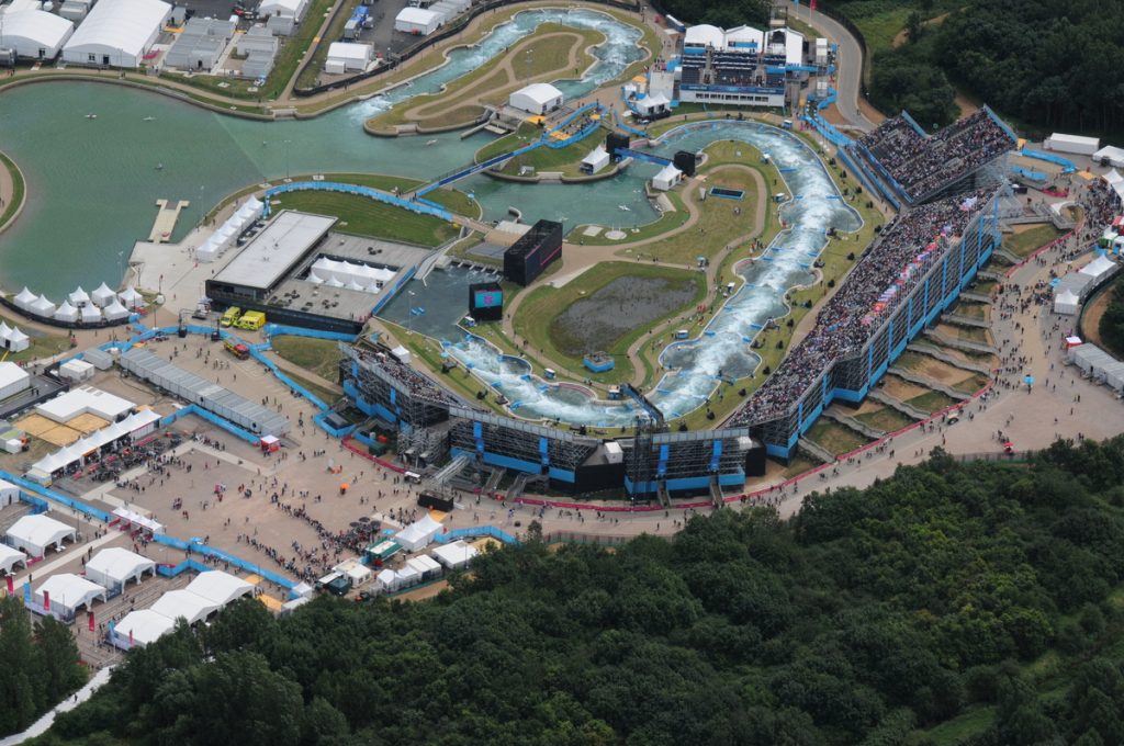
Calibre’s Whitewater Team proudly contributed to the Lee Valley Whitewater Centre, the iconic venue for...
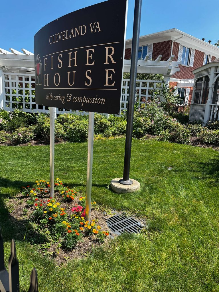
Calibre completed a comprehensive assessment of the storm sewer system for the Louis Stokes Cleveland...
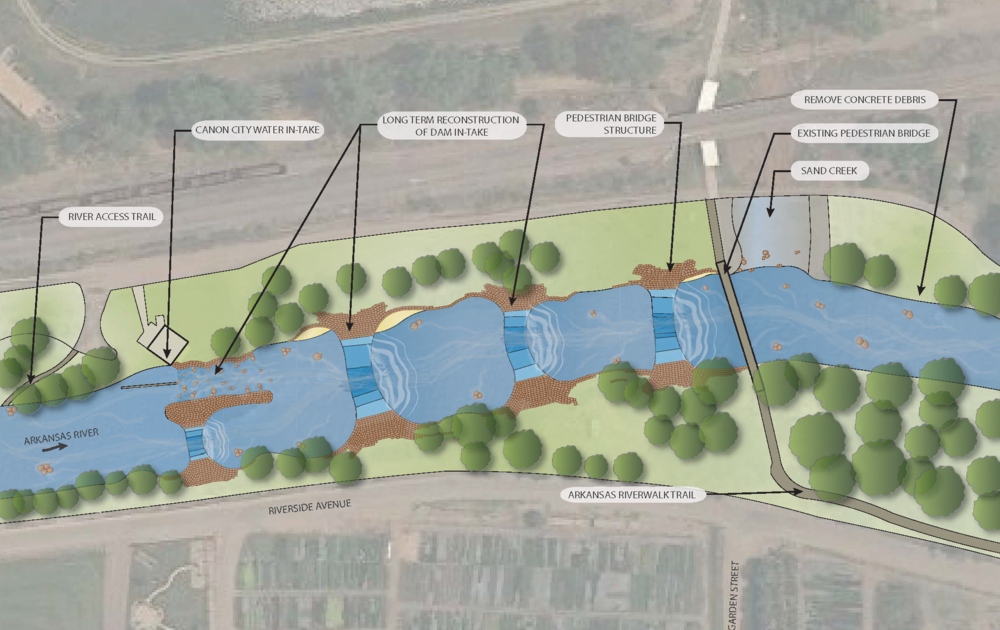
The Arkansas River is the main recreational attraction in Cañon City. Locals and visitors are...