Civil Engineering, Water Resources Engineering, Whitewater & Rivers Engineering
Private
Master Planned Development, Parks & Recreation
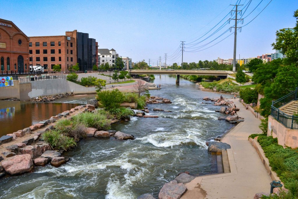
Located in the heart of downtown Denver, the South Platte River Rehabilitation project spans one...
Whitewater & Rivers Engineering
The 2013 Colorado Flood washed away approximately 3,600 square feet of riverfront property of a...
Civil Engineering, Federal Services Engineering
Federal & Military
Healthcare & Research
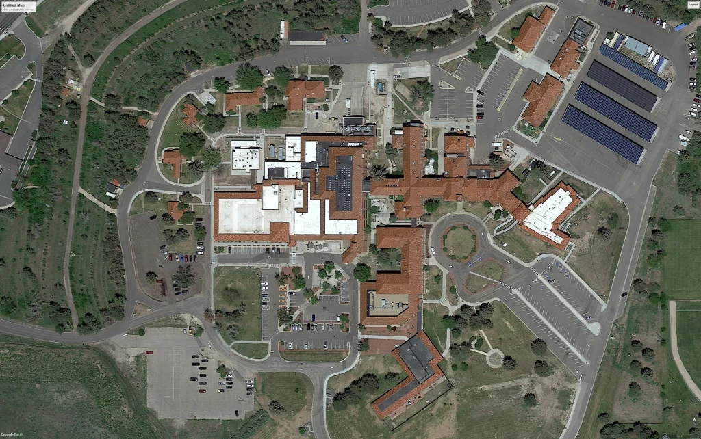
The Grand Junction VA Medical Center project includes 50,000 square feet of infrastructure. Calibre delivered...
Civil Engineering, Municipal Services Engineering
Municipal
Mixed-Use & TOD, Residential
The I-25 Erie Gateway is a transformative 600-acre mixed-use development designed to be a vibrant,...
Parks & Recreation
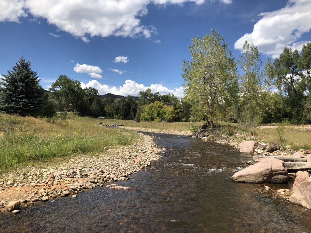
The Arkansas River is the main recreational attraction in Cañon City. Locals and visitors are...
Civil Engineering, Federal Services Engineering, Structural Engineering
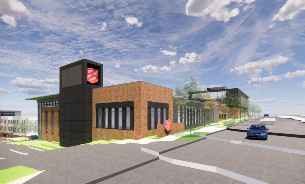
Calibre worked on the expansion and reconfiguration of the Emergency Department (ED) and the creation...
Master Planned Development, Transportation & Parking, Water, Sewer & Storm Infrastructure
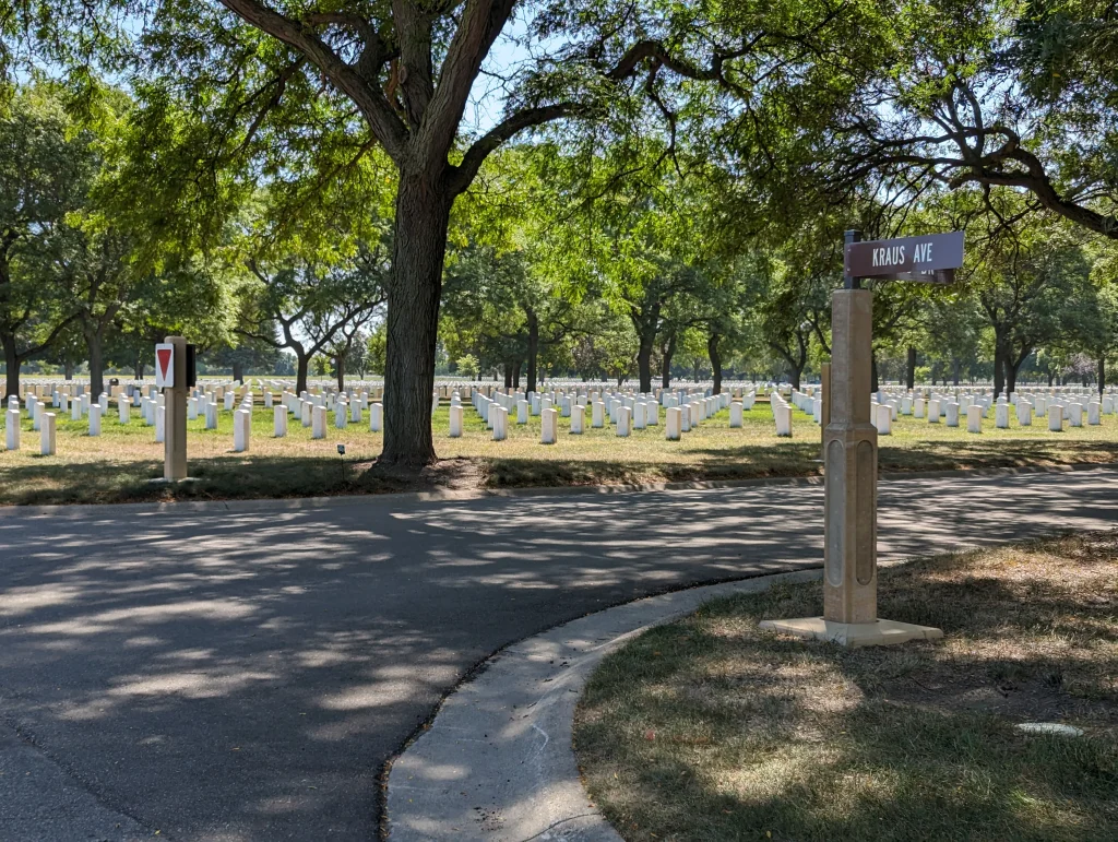
Calibre provided civil engineering services for the Fort Snelling National Cemetery, located in Minneapolis-Saint Paul,...
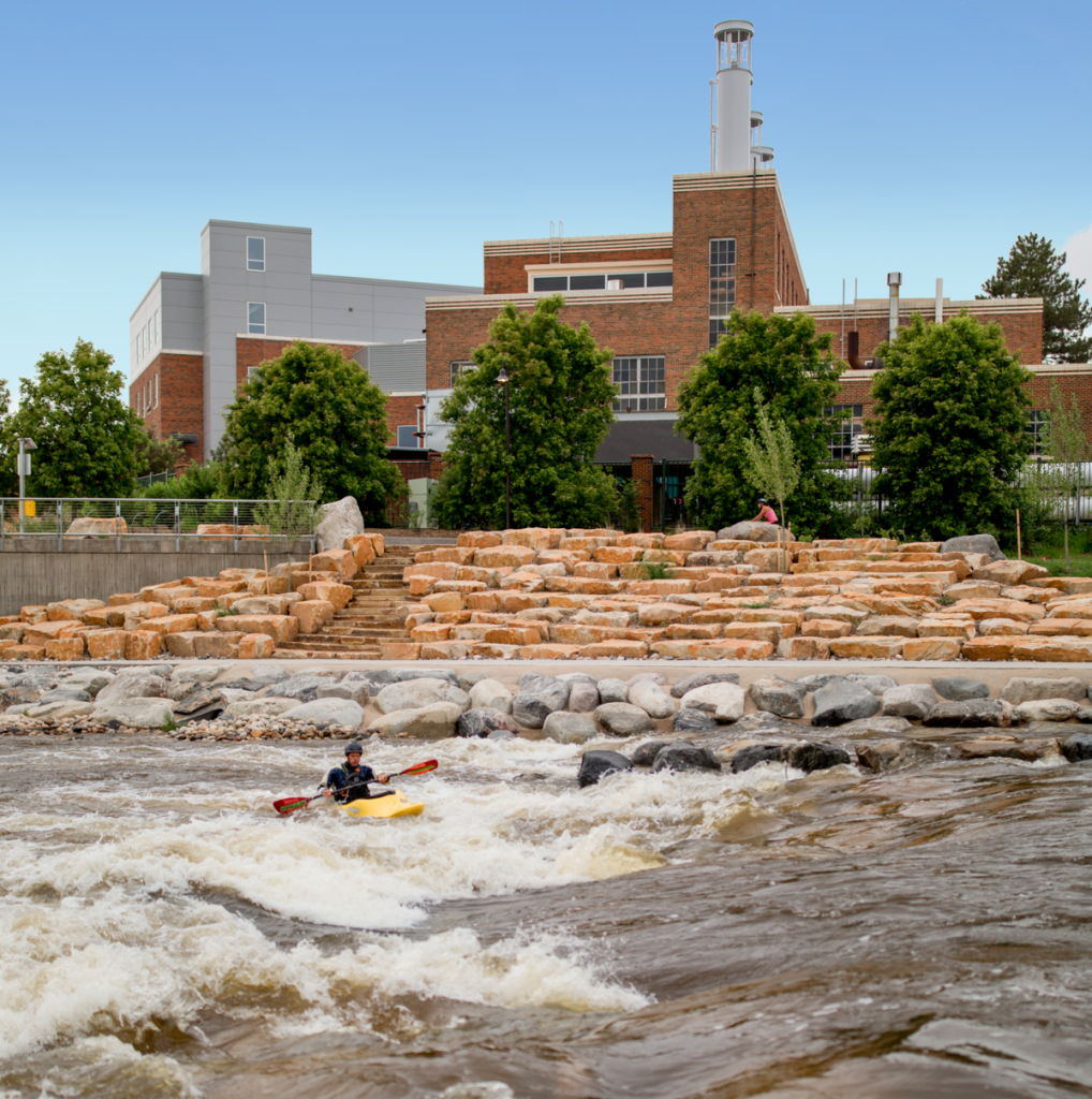
Municipal Services Engineering, Whitewater & Rivers Engineering
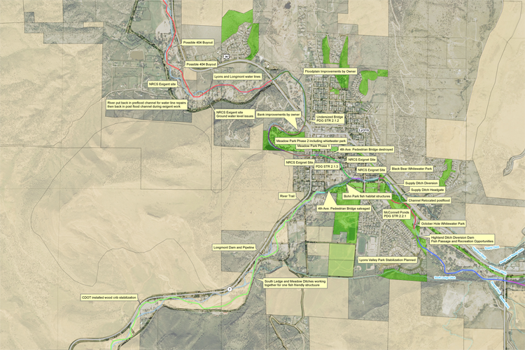
Calibre’s Whitewater Team played a pivotal role in the development of the South Saint Vrain...
Construction Phase Services Engineering, Municipal Services Engineering, Structural Engineering, Swiftwater Rescue Facilities Engineering
Education & Training Facilities
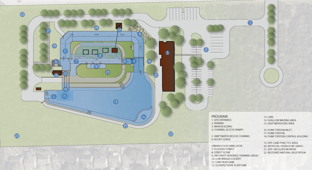
The Houston Swiftwater Rescue Facility, which spans over 50,000 square feet, seeks to enhance water...
Transportation & Parking, Water, Sewer & Storm Infrastructure
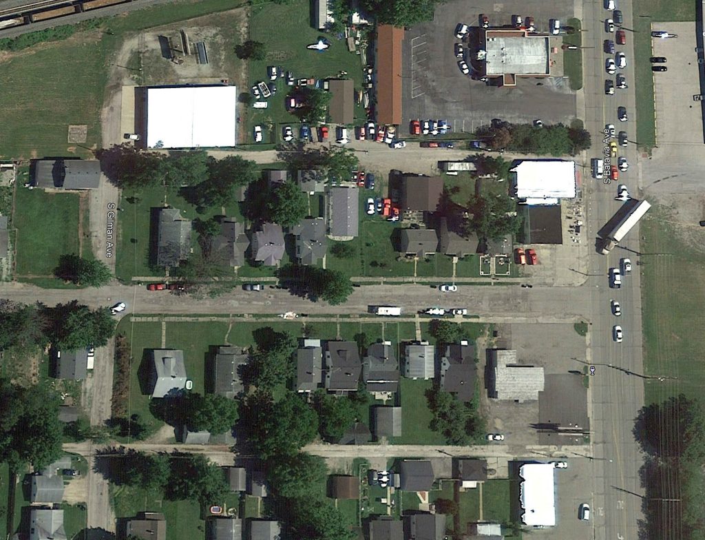
Calibre served as the on-call civil engineer for the City of Muncie, Indiana, overseeing a...
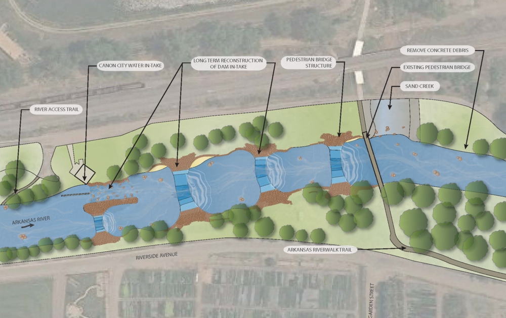
The Poudre River Park was developed to transform an abandoned diversion structure into a vibrant...
Aviation, Commercial / Office / Retail, Cultural & Religious Facilities, Parks & Recreation
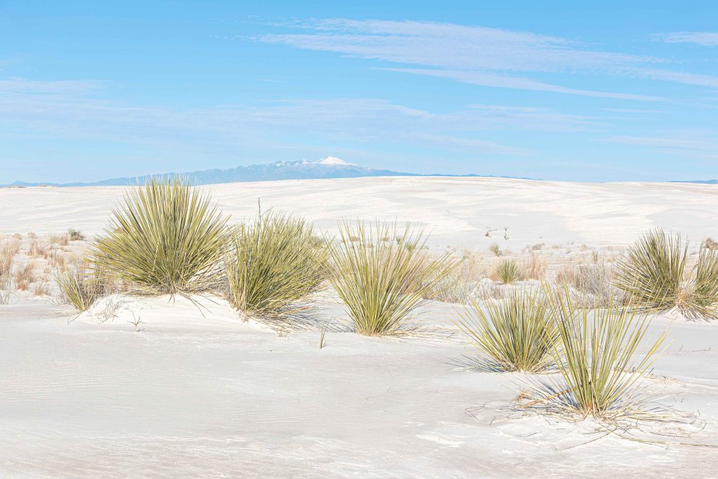
Calibre worked on this rehabilitation project at the historic White Sands Visitor Center. Spanning 8,600...
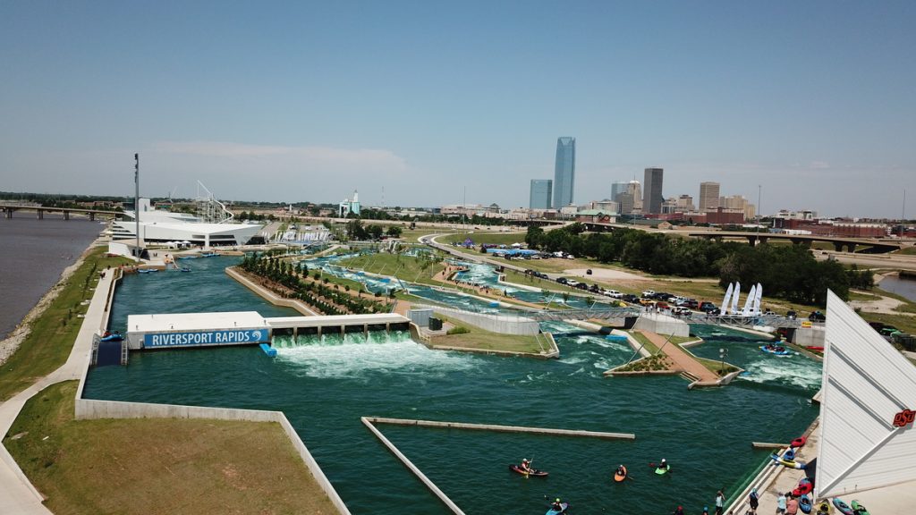
Riversport Rapids Whitewater Center is the first pumped-park globally to offer a recreational, a competition,...
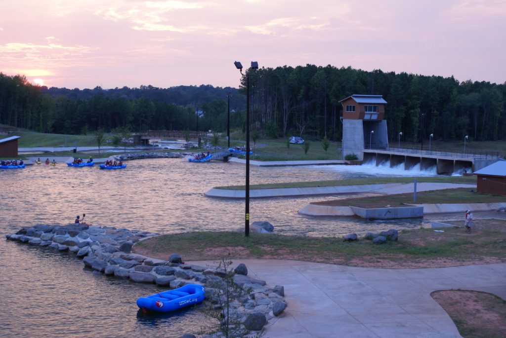
The National Whitewater Center is the largest and most profitable whitewater park of its kind...
Civil Engineering
Aviation, Master Planned Development, Mixed-Use & TOD
Calibre is providing civil engineering services, including due diligence, site planning, and infrastructure design for...
Cultural & Religious Facilities, Parks & Recreation, Residential, Water, Sewer & Storm Infrastructure
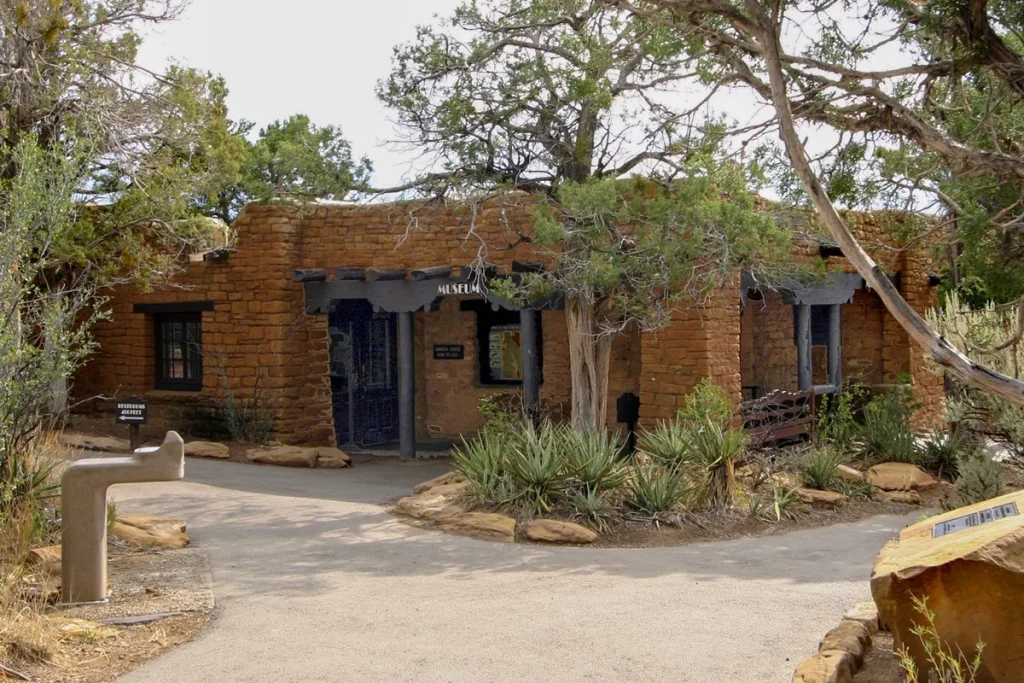
Located within the historic Chapin Mesa Historic Buildings and National Historic Landmark District, this significant...
Municipal Services Engineering
Parks & Recreation, Transportation & Parking
Calibre undertook the conceptual layout and cost estimation for a pivotal bridge extending from the...
Residential
Calibre provided civil engineering services for this redevelopment on a 5.1-acre site, which included renovating...