Aerial view of a mountainous area with damaged roads and buildings caused by flooding; mud and debris cover parts of the landscape, with some trees and houses remaining—an urgent challenge for Colorado engineering teams.

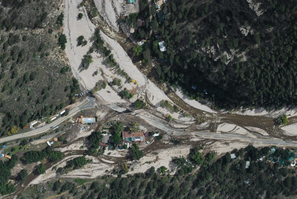
It has become a high priority for several states including Colorado to identify fluvial hazard zones (FHZ) as a part of their long-term river corridor planning. During the 2013 Colorado flood, about half of the private structure damages occurred outside the FEMA designated Special Flood Hazard Areas (SFHA) partly due to river fluvial processes such as channel erosion, deposition and lateral migration.

Therefore, the Colorado Water Conservation Board (CWCB) is currently performing a pilot FHZ study based on Colorado Senate Bill 15-245 to identify fluvial hazard zones for the pilot study areas and develop regulatory methodology, criteria and guidelines for FHZ mapping. Information about CWCB fluvial hazard mapping could be obtained from http://coloradohazardmapping.com/hazardMapping/fluvialMapping. Additional information is provided in the FHZ fact sheet.

Blog Categories
Share Article:

Recent Posts

Abstract geometric background with red, yellow, and green shapes. Text reads: Reflections From Leadership. CHOOSING We. Calibre.
February 26, 2026

In recognition of Black History Month, Greg Murphy, Calibre’s CEO, considered the examples set by...

Illustration of Martin Luther King Jr. at a podium with his arm raised. Text reads: Reflecting on Martin Luther King Jr. Day: Choosing Hope. The Calibre logo is in the lower right corner.
January 19, 2026

There are times when life feels heavy. When the world around us is loud, fractured,...

Rows of headstones in a cemetery with wreaths placed on each. Text reads: “Wreaths Across America: A Reflection on Unity, Service, & Remembrance.” Calibre logo appears in the bottom right corner.
December 18, 2025

At Calibre Engineering, our mission of exploration, service, and support extends beyond the projects we...